


I suggest you read Part i — the previous post — before reading this part. Some points are valid from post to post, and it would be boring to repeat them each time. Reading the comments is also fun and educational.
This review of the options always starts at the Bayview Station (top right corner), ie I talk from east to west.
The O-Train corridor option uses existing transportation corridors to take the LRT south then west. It would bump the Otrain off its track, forcing it to terminate at Carling. This LRT option is unlikely to be selected as it has some severe engineering problems:
- it uses up the prime north/south corridor route into the downtown for the east-west service. It will be difficult to widen that cut for four tracks.
- the turn at Carling to go west is very sharp. If the LRT continues under Carling and then swings west, the curvy deep cut will severely restrict future development of the sites on the south side of Carling (despite being grass now, they are not parkland, they are redevelopment sites in training). [note: air rights are developable over straight LRT tracks but very difficult to work out on curves].
- the deep cut then has to cut back under Carling (near Sherwood) to access the median alignment, and then promptly go up the steep hill to the west. The steep hill is a real challenge for an LRT at grade, it is likely impossible to climb the hill and climb out of a 20′ deep cut too (so I am told).
- an alternative geometry would have the LRT start climbing out of the cut at the Queensway, be at grade by time it reaches Beech Street (closing Beech) and then rising to an elevated structure 20′ above the adjacent houses before swinging west at 853 Carling (impairing development of that site too) and remaining elevated along the median until it meets the incline as Carling goes uphill to the Farm. Ugly.
- there is limited development potential along this portion of Carling, assuming the Farm is undevelopable. Westgate mall is a prime redevelopment site but is not large.
- a separate stub line or bus service would be required from Bayview to Tunney’s, complicating matters
- a OC Transpo bus transfer station would be required at Bayview, in addition to the proposed STO rapibus station
The Holland Avenue option: unlikely choice, as it is difficult to service the major employment centre station at Tunney’s Pasture and then swing south; there is severely limited redevelopment possibilities along the route; and it would be a difficult sell to put in an intermediate station to service the generally low density surrounding neighborhoods, especially if that station had to be a bus transfer point. It also does not include much benefit to the redevelopable area of Scott west of Tunney’s.
Island Park is another choice, it has easier turn radii at the north and south ends, making turns from the transitway cut on the north and onto Carling at the south, much easier. Otherwise, it suffers from similar problems to Holland: low density, limited redevelopment potential (so long as we continue to view single family low density inner suburbs as sacrosanct), and offers much mid-block station design and access grief.
It is worth pointing out here that all these north south linkages assume the route will be cut and cover, ie the road will be dug up, a trench cut into the base, the track laid, the trench covered with dirt or bridged over with a concrete road surface. Once built, the LRT would be invisible underground.
Kirkwood/McRae is a wide corridor with similar assets and liabilities as the others, but with a easy turn radius at the north end to connect to the existing transitway cut countered by an awkward jog to get from McRae to Kirkwood (unless it ran under the Loblaw’s parking lot).
The Tweedsmuir Hydro corridor option is the first non-road option. It would follow the electrical utility corridor. Like the others, it would be cut and cover, operating underground throughout its length. Hydro One has serious objections to this route, claiming, amongst other things, potential electrical interference between the LRT and overhead wiring. (nice to know, if you live along that corridor…) At least the corridor option gets planners thinking about it as a corridor. If not used for the LRT, I think it should be aggressively redeveloped as a pedestrian and cycling spine: it has fewer intersections than adjacent streets, it could be pleasant and scenic.
The Churchill and Broadview corridors permit the continued use of most of the existing transitway trench and the Westboro Station (although a good argument could be made to relocate the Westboro station to a new location under the Churchill/Richmond road intersection, except that handling bus movements becomes awkward). Most of Scott Street has with ample opportunity for infill development on its south side (eg, decaying industrial stuff at McRae; the former CBC Lanark Avenue site on the north side is already identified for intensification). The Churchill corridor services office parks at the Carling end and would promote intensification along the Carling corridor going west.
It is interesting to try to forecast the impact any of these north-south segments would have on adjacent neighborhoods. Right now, the city lacks the will to permit large scale intensification of these neighborhoods, permitting mostly smaller infills of singles and duplexes. The city does encourage intensification on the east-west segments (Scott, Richmond, Carling), but is that enough to justify the N/S LRT service? There is no doubt in my mind that the presence of LRT service and a walk-in or local-bus transfer station would drastically increase house values and land prices in the area. However, there is literature that says it won’t actually increase ridership, since those affluent households will continue to use their (multiple) cars for most trips. Transit-generating intensification needs to include housing for lower-income households, starter households (our childrens’ first houses), downsized homes, student housing … none of which are likely in premium priced trendy urban neighborhoods characterizing these north-south streets.
Along Carling itself, the planning takes it for granted that intensification and redevelopment is good and will proceed apace. The land owners are on board, as is the city’s official plan. But there are many hurdles to implement that rosy scenario: I expect many merchants will object to reduced left-turn options when the Carling median has LRT on it (intersections must be minimized). For longer-haul riders, the Carling route is likely to be the slowest option, as no amount of signalized intersection priority will permit the same speed and level of service for transit users as a separate right of way would provide.
For adjacent residential areas just off Carling, will they be enthusiastic about high rises, high-intensity residential and commercial redevelopment along Carling? Or will NIMBY be the operative word? And finally, I have some concerns about the rosy pictures planners paint of store fronts directly on Carling Avenue sidewalks thronging with pedestrians and shoppers … I think Carling will remain a busy vehicular arterial that is not conducive to pedestrians, cyclists, or shoppers. See Bronson, where high rises and higher densities alone do not an attractive main street create. After all, most of the neighborhoods surrounding Carling are also products of the 1960’s auto-fetish and to take the car is the dominant mode of getting anywhere.
All of the Carling options must make a sharp turn south at Lincoln Fields. The existing station location to the north of Carling, conveniently close to high rises and the redevelopable shopping centre site, is unlikely to be salavagable. Instead, a new station would be further east of the turn, or maybe further south more adjacent to Woodroffe High School, a location that lacks significant redevelopment potential and which is further way from the walk-ins generated by high rises. Could OC Transpo actually get a bus station in the “greenspace” behind the very high priced homes there?
Earlier plans for the Pinecrest Creek portion — where the existing bus transitway now runs — included keeping the BRT from Barrhaven open to Lincoln Fields and building a parallel LRT line to College station. This is looking increasingly financially unattractive. We simply cannot afford two high volume transit services in the same corridor, the land take is greatly increased, and the traffic volume for each is effectively split in two, making it harder to justify keeping the BRT.
And what of BRT connections to the west, along the Queensway or at Roman Avenue? Many options are being kept open, selecting any one will have significant impacts on the viability of the others. If the BRT is kept open to the Qway, should it be kept open to College Station too?
At Iris, the transitway currently has an mini-station at grade. The situation is difficult: Pinecrest creek passes diagonally under the current intersection. It is difficult to either submerge or elevate the LRT due to the slopes and creek. There isn’t enough room to submerge or elevate Iris, before the road is in front of existing housing. This leads to the suggestion to close off Iris to motorists, ie there would be an Iris west of Woodroffe, and another Iris east of Greenbank, but not connected. This might actually appeal to many local residents. Another consideration is fire and other emergency access. A pedestrian-cyclist e/w crossing would continue with a grade-separation structure.
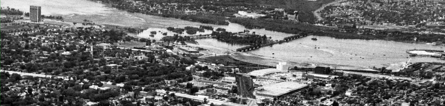
Tomorrow: the Ottawa River corridor options.
I take it you’re getting all this from a presentation you went to?
I would point out that Churchill is undergoing gradual intensification, and the street itself has always had a mix of housing along it. Hydro seems to be engaging in its own form of FUD with respect to the hydro corridor. As for the O-Train/Carling routing and the difficulties that route presents, I fail to understand why they don’t just keep it on the south side of Carling all the way to Holland/Fisher (it would require removing two lanes from Carling and reshuffling the road and its median, but a median alignment requires that too). At least dealing with stations is easier.
Anyway, the most interesting point in the post is the discussion of Iris. This, to me, tells us what’s wrong with the way we do transit planning in Ottawa and how deeply ingrained a freeway mentality has taken hold. Iris currently has an at-grade BRT crossing. Since LRT involves fewer vehicles travelling less often, an at-grade LRT crossing is less of a problem that a BRT crossing – and yet idiotic ideas like closing off Iris are being voiced. Why? Iris is beyond Lincoln Fields where they’re going to have to short turn trains to serve passengers arriving from Kanata (so they don’t have to pile into fullish trains from Baseline, delaying those trains). So whatever frequency is operating between Tunney’s and Lincoln Fields, something like half that frequency will be operating at Iris. There’s just no need for grade separation here, and certainly not for pedestrians and cyclists.
We seem to be designing a fully grade separated system, yet we’re going to run light rail on it, presumably low-floor vehicles. One of light rail’s advantages over BRT is that it requires fewer grade separations, and one of its advantages over light metro is that not everything has to be grade separated. But, if, as appearances suggest, the system is going to be entirely grade-separated, there is absolutely no point in putting LRT on it. None. Go for light metro with automation and high-floor vehicles. Either make it a light rail system with grade crossings to save money, or go for light metro if it is fully grade separated.
At any rate, these guys aren’t even too imaginative with respect to grade-separating Iris: just relocate the Pinecrest Creek to the west side of the transitway (it crosses twice more nearer Baseline), getting rid of that diagonal crossing. It can’t be doing the creek any good to be underground for that distance anyway (it’s about the same as the Queensway underpass). The “stub” of the creek that would be left on the east side can be turned into a stormwater pond, with its direction of drainage reversed. With the creek no longer going below the intersection, the light rail line can go under Iris, thereby keeping the cars moving without interruption from transit, since that appears to be the motivation for the entire project.
Yes, they certainly seem to want a fully grade separated system, and I have heard the consultants talk about upgrading the LRT later to a metro-type operation on the same right of way, when the current LRT reaches capacity. An awful lot of the LRT r.o.w will be fully separated, it seems contradictory to leave some not, since that means we need operators on trains, whereas driverless trains allows the staffing to be someone useful to those on board, or more trains to run more frequently esp. in off-peak hours since the marginal cost of running the service is low.
One of the presenting firms on train technology made exactly your recommendation, to skip the LRT stage and go straight to light metro.
As for Pinecrest creek, I chalk up not rechanneling it to excessive environmental sensitivity. No cost is too high for taxpayers to pay to “save” a natural creek with its riprock banks, etc. A new scenic chanel is fine with me, and while they are at it, please uncover the lost portion running from Woody High to the Ottawa River.
If we’re talking about grade-separated service, then why not have the Carling option entirely grade-separated to avoid the intersections. Either cut+cover or run it elevated down the median.
I agree with the previous poster, if the prevailing view is to have it grade separated, then why not elevate it along Carling? I think the idea of going light metro with high floor trains has some serious merit as well.
Presumably the Carling option is not cut and cover nor elevated because it is the longest route and that would be very expensive. I am reporting and opinionating on what I know from the presentations; my ignorance of many things is no doubt well displayed.
I don’t think a turn at Bayview would be quite as difficult as you suggest, given that the Yonge-University subway in Toronto (or the planned curve from Rideau up Waller Street for the DOTT) has some tight curves in much more built-up areas. Firstly, there’s no compelling reason for the cut to be widened to four tracks. The n-s lrt would not be as frequent as the west lrt. Second, with all that undeveloped land there, there is the space to have a more gradual curve. I don’t think you would try to bring it above-grade until you’re at Irving Avenue, since that hill is likely too steep for a rail vehicle, anyways.
Great post. Thanks for this series! It’s been extremely informative.
Just one minor point though: “further” and “farther” are different words and mean completely different things 🙂
Paul: Whilst you ended your comment with the further farther distinction, but din’t define it, I did look it up. The definitions are virtually identical, the definitions define further as being farther, and farther as being further, and one even says they are interchangeable today although there used to be a difference with farther meaning distance and further being metaphorical. And, uh, no, I satisfied all my curiousity by looking it up and nay, I shan’t discuss it any further.
Another obstacle to severing Iris is that it is one of the few streets into that neighbourhood that is not traffic controlled during rush hour. I live in Centrepointe, and drop my youngest off at a school just north of Baseline, but cannot turn into the neighbourhood off of Baseline. The only way in is to take Baseline, turning left at Woodroffe and then left again at Iris.
I guess the draconian no-turning rules are there to preserve the neighbourhood from a deluge of rush hour traffic. But considering that it is also illegal at any time to drive across Baseline heading north from Centrepointe, maybe it’s just a prickly neighbourhood.
Regarding the Carling corridor, I like the Churchill alignment. Of all the NS streets identified, it is the one most likely to see significant positive change. I’m less concerned about difficulties in maintaining grade separation along Carling to Lincoln Fields. I would suggest dropping under the intersections that cross the rail alignment and reducing the number of such crossing intersections. If the first Carling station occupies the block between Churchill and Clyde below grade (it has to be below to reach the median) then those two intersections are retained. Eliminate the Broadview, Iroquois and Edgeworth crossings. And add U-turn channels at each end of any covered portions. I’ve seen these in the States and they work well. It’s a dedicated left turning lane before an intersection that just lets you perform a U-turn and only a U-turn. It diverts traffic away from congested intersections.
In effect, you take away a connection by closing the cross-street, and then reduce the impact by giving someone a way to get over the rail line without driving too far or going through traffic lights to do it. And it can easily be combined with a pedestrian crossing by channeling the pedestrians between the two U-turn curves. Once the light turns red at the crossing, the U-turning cars and crossing pedestrians share the crossing with absolutely no contention. Combining these ped crossings with access to below-grade stations should work quite well.
The hoped-for end result is to reduce the costs in comparison to a cut & cover by reducing the amount of ‘cut’, and drastically reducing the amount of cover. The train need only be fully below grade where covered (a few intersections/stations and ped/U-turn crossovers) and would be free to climb out of the trench as much as desired in between.
I wonder whether the hill heading west from Maitland would be too steep. If the line is passing under Maitland then the train might stay in a relatively deep trench most of the way up the hill. It might end up being cheaper to sink the intersection a bit, and mostly elevate the line over that one intersection. That poses a problem for station location though, as an elevated station should probably be avoided. If we assume there’s a station at Churchill, and one at Carlingwood then the gap is about 2km. Maybe moving the Churchill station could move a bit west, but the Carlingwood station has a hill to the east and unless it’s going to operate in a trench all the way up the hill, it would need a bit of space to get up to grade.
Peter: presumably if Iris was cut in the mid-point it would be necessary to re-examine all the other traffic restrictions around the perimeter since the Iris through-street may have been an important goal for motorists.
I’ve also seen those U-turn channels in medians and they work well, for cars. The turning radius on the ones I recall was tight. I am afraid that our engineers would want them big enough for school buses, 53′ tractor-trailer rigs, etc and they would grow into highway-interchange proportions.
I wonder exactly how the city proposes to use the Carling median for LRT. If it is depressed to go under intersections, we are back to wide cut like the transitway along Scott. If it is surface for most if not all intersections, I cannot think it will be efficient and timely (despite the plans that it should work, it is a big jump from the planning board figuring out timing to the real world where people make mistakes, it snows, etc). If elevated, we are looking at huge overhead beams and catwalks and large overhead station structures. Sometimes, all the choices seem to be all problems. It’s enuf to make the ORP look simple!
The ones I saw allowed cars to cross under highways from one parallel collector to another parallel collector without contending at an intersection. It seems like a reasonable facsimile of the current topic, although it would be a tighter turn. I think school buses would make it, but trucks should be banned, both because the turn is tight and because a truck tipping it’s load during the turn could shut down the entire LRT line.
Like you, I have concerns about how Carling would work. I’ve got ideas but they’re not based on enough knowledge to be useful for anything but brainstorming. I’d love to see an LRT expert analyze the Carling corridor. If the problems are too hard to overcome then for me that pretty much leads to an automatic selection of one of the Richmond/Byron variants.
If Carling isn’t a primary LRT route then I would still like to see it as a secondary route, and that wouldn’t be a bad thing since a secondary route could continue east down Carling well past the point a main line would need to turn north. Secondary LRT service to Herongate, Westgate, ROH, Civic Hospital, CEF, O-Train@Carling, Preston and the fed complex between Booth and Rochester would provide value.
Personally, I would love to eventually see a network of secondary routes. Billings Bridge to downtown via Bank is one I’d really love to see.
Hi, I realize I’m really late to this post. I take the 95 from Iris station to work every day, and I was wondering what might happen to the station when LRT comes along. I googled it and came to this blog entry.
I must say I’m disappointed, although understanding, that this small Transitway stop is going away with the LRT. It makes sense: there is a very low density of dwellings, with no significant commercial, retail or business establishments within walking distance. However, I can’t help but look around the station and see lots of empty land and bush. If we were to leave the stop as an at-grade tram-style stopover on the way to Baseline Station, we could justify some significant mixed-use development/intensification. I could see, for example, a multiple-storey condo with office and retail space (sort of like a much shorter version of Soho Italia), at the northwest corner of the Iris/Transitway intersection. We could also provide one car lane in each direction on the current Transitway, connecting Baseline to the Ottawa River Parkway. To me, it’s a very unique spot that could be easily accessible via rail, automobile and bicycle (which is extremely rare in Ottawa). With so much variety of through traffic, it would be very attractive to retail vendors. It also goes without saying that parking spaces would be justifiably few.
Obviously the local residents would not go for such a scheme, but is this not an opportunity in keeping with the Official Plan?