


Preston Street is being extended from its present northern terminus at Albert, out across the Flats to the current transitway. This is supposed to open in January 2015, ie 2-3 months from now. After an intersection with the current transitway, it will cross over the aqueduct on a sort of culvert. The steel pieces of the culvert are out there now. They will be placed in the aqueduct to prevent the roadbed from filling the canal and crushing the giant water pipes there.
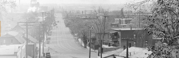
The historic aqueduct starts at the Ottawa River just west of the War Museum entrance at Vimy Drive / Sir JAM Parkway. The waterway runs east through the Flats, closely parallel to the transitway. There are five stone arch bridges over it.

It ends at the headwater of the Fleet Street pumping station, and then exits through the tailrace — where the kayak course is — to rejoin the Ottawa River at Richmond Landing.
I presume those metal arches will be placed on the exposed bedrock shown in the pic below. It will be interesting to see what care they take of the historic armoured stone walls on either side. When the City installed water pipes here back in 2006 or so, they weren’t exactly gentle or respectful of the historic designation.


Here’s where the Preston extension begins: the drawing shows Albert street across the bottom, and the Preston extension running northward across the Flats, starting out in the same rough alignment as the ped-cycle road surface there now (which is shown “ghosted” to the left of the new road surface):

Note that there will be a off-road bi-directional cycle and ped track on the right or east side of the new road. Just before the new road reaches the existing transitway, it crosses the future alignment of the new LRT guideway (the guideway and Preston extension will never be in the same place at the same time…)
The next plan shows the intersection with the transitway and the crossing of the aqueduct:

Preston will then intersect with the Sir JAM Parkway at the Vimy intersection that is already there. The City has been bustin’ to widen the Parkway, that’s why the “parking lanes” out there are such minimally disguised traffic lanes. By January 2015, the parkway there will be four westbound lanes in front of the museum, and two eastbound lanes (like now, but located where the south side parking lane now is).

Booth will be closed for a few years to allow for construction of the Pimisi Station and rebuilding Booth between Johnny Macdonald and Albert as a four lane arterial, in the Bronson Avenue school of design.
The whole Preston extension is a temporary road. Throwaway infrastructure. (In order to be permanent, a $20million bridge up over the LRT and Aqueduct would be required, and the City wants to stick that bill to the NCC when it develops that part of the Flats).
The Preston extension will be rolled up and trashed in mid 2016, when Booth reopens, and then the LRT guideway will be cross the “former” Preston extension.
The Preston extension actually has a city street name approved several years ago, that extension not being named Preston (as the current street numbering starts at Albert and increases going south on the existing Preston) nor Vimy, (where the numbering starts at the SJAM parkway and increases going north. Does anyone remember what street name the city chose?
Millions on thinly veiled highways built a couple blocks apart with minimal and mediocre pedestrian and cycling components all designed to be ripped up because the city is too cheap to do it right the first time while bulldozing heritage and good taste:
Sadness Ln.
The NCC sticks the City with a large bill for use of its land for the future WLRT while the City sticks the NCC with a large bill for a Preston extension. Seems legit.
Since the NCC is perennially short of funds (to an extent that the City isn’t), I’m just waiting to see how long it takes for the NCC to relent on its unreasonable demands vis-à-vis the WLRT in exchange for the City building a proper Preston extension.
Why are they building a new bridge over the aqueduct instead of running the road over the bridge 5 ft to the west?
I am officially coining a new street name – the Sir Traffic JAM Parkway!
I am confused about the Lebreton station locations shown. I thought all the busses were running on Albert?
If you look at LeBreton Station today, it has platforms on both the Transitway and Booth (northbound), to serve buses headed to Gatineau. The same will be true of the temporary LeBreton Station.
The odd part is that they will have two temporary platforms for this northbound bus traffic. The first one will be located on the Preston extension *north* of the transitway during 2015. The second one will also be located on the Preston extension, but between the transitway and Albert during the first half of 2016. I’m not really understanding why they don’t just build a single temporary northbound platform at the midpoint between the transitway and Albert for the entire duration of Jan 2015 – Jun 2016.
Like Matt Rose, I also cannot understand why they are constructing a temporary crossing of the aqueduct when a solid crossing appears to exist just metres away along the actual Preston alignment. My best guess is that this is to allow for an actual bridge structure over the Confederation Line to be built simultaneously should the NCC & City decide to do so.