


The Rapibus bus way runs parallel to a rail track. It is very straight. The rail tracks were left in place for (very) occasional trains, preserving some industrial opportunities. And more nicely from our point of view, it facilitates eventual conversion of the bus way to rail. (STO did not go immediately to rail for the same reasons — traffic volume and cost effectiveness — Ottawa went for a busway in the 1980’s instead of rail, a decision that still rankles some transit aficionados).
The rapibus route has a number of intersections at grade with busy cross roads. The presence of a busy parallel road on the ‘other side of the tracks’ further complicates matters. At https://www.youtube.com/watch?v=D3EANU4FmiI you can see a LRT operation in similar conditions. The big risk in this alignment is the possibility — nay inevitability — of collisions with vehicular traffic. When it first opened, Gatineau’s Rapibus did meet some cars.

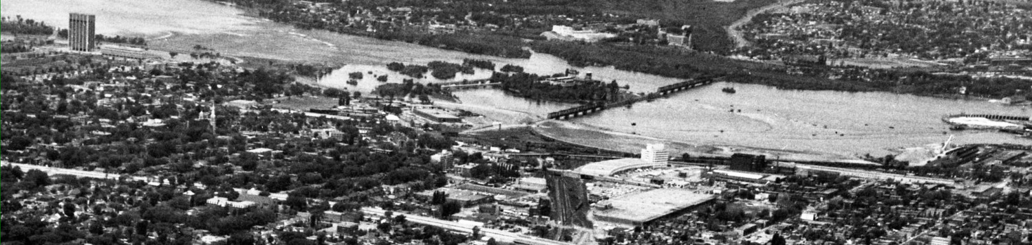
West of downtown Gatineau, the Rapibus route (temporarily) shares a road to Aylmer. From downtown, it follows the rail right of way somewhat parallel to Hwy 50. The downtown end is remarkably close to the Prince of Wales RR bridge over the Ottawa River, which the City of Ottawa owns and manages to avoid using (ideal experiment for those extra OTrains the city has in storage…). Following the tracks, it passes in front of the DND office complex and Casino, and then parts from the Hwy 50 by going a bit north and crossing the Gatineau River on a very high steel bridge built in the 1880’s (new bike track to the side is also visible in the pic).


The RR bridge is narrow, too narrow for a two way roadway. Rather than “widen” the bridge, it handles alternate flows with a simple traffic signal. (It was the inability of Ottawa to avoid double tracking the tunnel under Dow’s Lake that drove up costs of the N/S light rail proposed by Chiarelli, ultimately helping to kill the project).
To see how this works, take the driver’s seat on a STO bus:


(bridge photos from David Jeanes, Transport Action Canada)
Did you notice how simple, how low-tech the solution is? And the bridge remains usable by trains! I simply cannot imagine the City of Ottawa agreeing to such a simple signalling system.
During peak hours, the Rapibus finds it better to use the bridge with one direction priority and the return buses are rerouted to the nearby mixed traffic road. The Rapibus busway is new and traffic volumes allow this arrangement; eventually they will outgrow it.
For a while, there were drawings circulating showing the Prince of Wales bridge over the Ottawa River as an extension of the Rapibus route from the Armoury in Gatineau over the River to Bayview Station, where Rapibus patrons would transfer to the transitway / Confederation Line. For various reasons, including the reluctance of municipalities to properly upgrade their networks in a timely fashion, I would prefer to see the O-Trains extend over the River (also do-able on a single track bridge for the initial period) to the Rapibus terminus and then to Pl de la Chaudiere and downtown office complexes.
All along the Rapibus route there is a parallel bikeway, including over the high level bridge at the Gatineau River.
When the Rapibus road first opened, Gatineau made major transit route changes, eliminating direct express buses from the suburbs to the downtowns. The additional transfers and travel time caused outrage, and Gatineau restored many express routes, which somewhat negates the cost effectiveness of the busway. I fully expect similar screams of anguish when the Confederation Line opens in 2018 and bus users discover more transfers, a much high ratio of standees than they are used to on express buses, and possibly slower service. When Phase 2 opens, expect more outrage when transit users finally discover what it means to be “sewerized” for much of the route, lest they see greenery or the river which apparently are exclusively for people who commute by private car.
The real, long term value of a separated transit route (busway, LRT, etc) isn’t apparent on the day it opens, since everything in its service area was built up during the automobile-dominant era. We all know urban form is a diagram of the forces acting during growth. So the transit line will come into its own as people choose to relocate, or locate for the first time, or choose their schools or places of employment, to be along the line. Essentially, the map of the city is redrawn with a long corridor of the city suddenly with much higher accessibility. * Eventually, the big box malls will add more buildings on the parking lots, parking will go under or over the stores, small houses will be replaced by towns, stacked, or apartments. The college will build a grand new signature building on the parking lot that currently separates it from the station, etc.

*Note, redevelopment at higher density will occur along the line only if Gatineau encourages it. When the City builds Hunt Club Road, for example, it rezones the land along it and a development frenzy ensues. Ottawa’s transitway / busway did not encourage increased development along the corridor because at the time of construction, the City promised adjacent community associations NOT to permit increased density or height. We lost 30 years of city building in that decision. Now, when planning the WLRT, the City promises no additional upzoning along Richmond, but since the City now plans on 5 and 10 year horizons they have ample opportunity to revise that, incrementally. Rezoning along the OTrain Trillium line has been wildly successful, with yet another 20-some-storey apartment just headed to market on Champagne Avenue. I fully expect to see some claims 10 years from now that the busway didn’t cause intensification whereas the rail line will, when its less a factor of the mode of transport than the fact of rezoning permissions.
Nicely written commentary with subtle nudges to the folks in the city of Ottawa, both to consultants and elected officials. But will any of them read this fine blog and its great illustrations?
How can we get it to them? Why not send the link to all councillors, planners and the mayor!
I was a Centretown resident for over a decade commuting by foot everyday and only using OC transpo to go outside of the downtown core. I remember thinking, the bus is not so bad… until I moved to Downtown Gatineau and despite changing provinces the 200 bus takes me from Rideau Centre to La Cite in 20 minutes. Plus free WI-FI!