

The instant springing up of a “friends of” organization to oppose rapid transit is not unexpected. Everyone wants transit nearby but not too nearby. Me included. At least one block over is just fine. Just like for arterial and collector roads.
I think the City falls short in its communication of the LRT options. Many of the complaints about each proposed alignment are eminently predictable, or have been already expressed (repeatedly !) in the media. If I were running the show, these complaints / concerns would be addressed right up front, either acknowledged or countered. Instead we have endless rehashing of shallow comments.
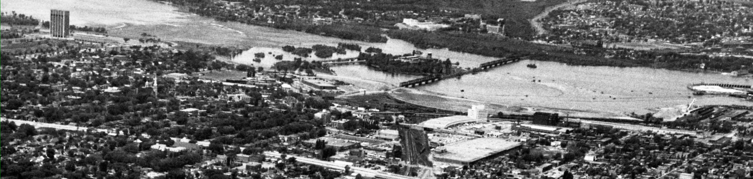
At prior PAC meetings on the western LRT, I suggested to the City that the argument that the north side of the Parkway option can’t be intensified, is a superficially powerful one since everyone can see the River is there. But somehow no one notices that other options (eg Carling option starting at the OTrain cut) have lengthy sections along undevelopable lands too ( is someone proposing we build on the Farm?).
And really, is Watson going to suggest that the affluent low-rise neighborhood to the south of the Richmond corridor is going to be redeveloped as high rises? If not, then it’s just as much a dead zone for redevelopment as the River (although over time McKeller park might be rezoned, but before that happens, it will become very very valuable real estate, a preserve of the rich, which argues it is unlikely to get rezoned).
I think the “developable area” argument is way too dependent on a visual perception of the potential area for development. It would be really helpful is planning staff drew some of their catchment circles around each station on the River alignment, and showed its current population and fully-built-out potential. And then do the same for Richmond Road stations. And I bet those circles would overlap geographically about 80%, and overlap population wise about 90%, and overlap with regards to redevelopment potential about 100%. In short, there may not be much “city building” or “ridership” difference between the options.
So why doesn’t the City make (public) some of those obvious rational analyses? Surely they were done as part of the criteria exercise? Maybe they prefer that “consultation” be a simplistic charade with the public arguing emotionally over the routes, and counting on Councillors to make the right decision when the “facts” are whipped out at the end. That’s showing an awful lot of confidence in Council.
 There are some other options that I don’t hear discussed much either. These relate to the overhead wiring that most people assume will be required along the parkway, and seem to find offensive. First, I have considerable faith that wiring can be aesthetically handled. It certainly should be much less a blight than all that road asphalt currently there. If the western LRT replaces then eastbound lanes of the Ottawa River Commuter Expressway, then the sea of asphalt becomes a field of grass, albeit with an overhead wire. And this is untenable??
Maybe we won’t require overhead wiring at all. When the international equipment manufacturers gave a presentation at the City a few years ago, at least one had battery powered LRTs already running, where they drew power from wires in some areas and in sensitive heritage areas they ran on battery. Since then, other systems have been built and run today where vehicles recharge rapidly while in the stations and have a enough “juice” to get to the next station. Again, no wires required in select high value areas.
That can also be a neat way to expand the LRT system since the core system is electrified, but each additional segment can be added as rail-only and electrified a few years later as volume increases. This makes it much cheaper to expand the service. Since we haven’t selected our train sets yet, the bidding consortia have a number of options open to them. Ugly wiring isn’t necessarily one of them.
In the meantime, the rather shallow debate on the western LRT makes for a quick read and then I can go do something more important, like sit in the sun.
You certainly addressed some of the Gray areas of the debate.
Life is very busy, and there is so much to read, i have had to edit down what I do read, and some things just didn’t make the cut. Talk radio, or talk jornalism, that focuses on cranking up controversy and exciting emotions, just doesn”t do it for me.
I disagree with your proposition that Parkway stations make only a small difference in terms of walkability. I think anything within 200m away by foot is prime transit oriented realestate. Putting the stations by the river means that everyone walking to the station will have an extra 150m walk past trees and bushes to get to the platform. There will be no prospect of a convenience store or takeout restaurant opening up that caters to the traffic walking past. Getting dropped off by a spouse as they take the car to work will be less appealing as you will still have a 150m walk through biting cold January winds sweeping across the Ottawa River. Transferring from the local bus is unappealing if it drops you off with a 150m walk to the LRT station.
The psychological distance will be different too. If you go past the station every day because it is on the main road, the station will not seem as far away. Putting it out in isolation in a field disassociates it from the community, only the regular commuters will consider it part of their “home territory”.
I agree with everything you say. A station on a walkable and walked street is much better for visibility, etc. That’s one reason I favoured moving the Westboro station from Scott to the President’s Choice location (Loblaws). On the other hand, you have a lot of assumptions there … such as buses won’t go out to the stations on some sort of loop, that there won’t be any retail opportunity at the stations (not that the city has been very open or imaginative for those for ANY station), and that the walk to the station won’t be wind sheltered or pleasant in January. A loop road running out to the station from Richmond, complete with landscaped sidewalks, ped lighting, and an underpass under the Expressway to the river edge, and maybe a corner store at the corner of this street and Richmond, can be envisioned. But alas, no info comes from the city as to what a station might llook like or how it might function, which opens up the debate to all sorts of speculation: yours being negative, mine being somewhat optimistic. Do not construe these comments to be that I prefer the ORP route.
Yes perhaps I’m being pessimistic, but I haven’t seen any indication that the planners have even thought about the design of the stations and how it will be accessed by bus/car and walking. For instance, if the station must be a straight stretch of track how will it work at Cleary where the parkway makes a sweeping turn? If the New Orchard Station on Richmond is at ground level how are people going to get to the other side of the tracks? Will people be allowed to walk over the tracks at the station or is there going to be a bridge and all the extra steps that entails?
These considerations shouldn’t be afterthoughts when designing for walkability. I’m not even sure that the decision to put two stations at Cleary and New Orchard has been rationally thought through for the Richmond route. Perhaps a single station at Woodroofe and Richmond would make more sense in terms of cost and in terms of access by car, bus and walking.
I’ve never understood this idea that stations must be in a straight stretch of track. (1) I’ve used metro stations in Paris and Stockholm that were on curves, and there didn’t appear to be any issue from a passenger perspective; (2) from an operators perspective, where are the places you have to slow down? Stations and Curves. so why not put them together, when you’re slowing down for one already?
@James
I’d say it results from a typical North American thought pattern: since we have so much spare space most of the time, we’re able to do things that seem like a good idea, like putting stations on a straight piece of track. This then becomes a defacto standard and eventually an actual one, even if it has no other basis than that it seemed like a good idea.
Hi Eric, is that picture of the Djurgårdslinjen (Line 7) tram in Stockholm? If so, it’s a pretty neat line: they run historic streetcars and new Bombardier Flexity trams on the same track; one of the vintage ones even had a lovely looking “dining car” trailing along behind!
Alas, I have no idea where it is, but I sort of thought it was Schrevenegen in Holland. I got the pic off the ‘net some time ago when searching for grassed routes. And some readers have bheen kind enough to send me pic during their travels, for which I do tag the pic with credit.
anyway, thanks for taking my call, love the show!
😉
That’s a HTM tram (The Hague)
One aspect of the discussion around the Byron/Richmond route I have not yet heard is why we would perpetuate the existence of two separate yet parallel roads with a skinny park between them. From my point of view, Byron Ave is utterly dispensable. Get rid of the street, shift the park to the south, and run the rail alongside Richmond. A few right-of-ways would be needed to connect the houses directly on Byron, but these would be short and infrequent since there really aren’t many houses on Byron. There are examples of these types of small access roads further west on the Byron linear park near Island Park Drive. Doing this would probably increase the amount of greenspace with very little impact on traffic capacity. Of course some street parking would be lost. It strikes me that Byron is mainly used as a parking lot around where it intersects Woodroffe.
It is indeed a puzzle. Echo Drive was cut up into segments that prevents cars from using it as a parallel thru-way, but permits cyclists and peds to do that. Byron west of Golden should do that too. I always remember a neighborhood activist giving me a drive along Byron in her Volvo – she never stopped at any stop signs and drove waaaaay too fast. I think of that scarey ride every time I bike on Byron. However, should the LRT go along the south side of Richmond Road, a number of the little cross streets that cut up the park — which, BTW, should be of great offence to the residents, they were certainly indignant when Our Lady of the Condos site proposed a driveway across the linear park — anyway, some of those little crossings are sure to be cut off since the only crosssings may be grade separated given the current mind set at city hall. So Byron might become more important rather than less.
@SteveD, the proble with moving the park is that destroys the park, it means cutting down 50 year old trees and replacing them with saplings that will take 50 more years to replace what would be lost in the move.
Instead, Byron could beamed effectively “east-bound Richmond” (without a name change, since there are adresses on it) and Richmond reduced to 2 lanes westbound (traffic, parking, bike?) and the rest of the space currently devoted to Richmond Rd could be handed over to LRT, preserving the park (almost entirely?). I wonder whether residents would complain about the traffic given the way they and many others currently drive on Byron? (as insanely as Eric’s anecdote, in my experience). More volume, yes, but also more reasonable speeds!
ONce the LRT is built, the existing Transitway connection from the Queensway to the ORP could be handed (back?) to cars, reducing the “regional” traffic on Richmond/Byron considerably. More cars on the ORP, but frankly, they’re better for everyone there than on Richmond/Byron).
While I agree that the current Byron / Richmond situation is odd, to say that “there really aren’t many houses on Byron” is far from accurate. Yes, there is a short stretch just east of Woodroffe where there’s a church and a bunch of low-rise apartment buildings. But on either side of that stretch are lots and lots of houses fronting the street. I don’t think their lot sizes are any bigger than others in the neighbourhood. So, even though there are houses on one side of Byron only, there are still lots of ’em.
I don’t know what the best solution is (converting it to be the eastbound lane of Richmond is interesting), but you can’t simply remove that road; cars have to get to those houses. You’d need a lot more than “a few” right-of-ways.
Let’s not forget that along most of Richmond (west of Golden), there is lots of room: that useless westbound parking / passing on the right lane (I’m surprised there aren’t more accidents there), the wide shoulder on the south side. Yes there are some narrower spots (why did they let the new condo at Cleary go right up to the sidewalk?), presumably this is were more of the park would be lost, but otherwise I suspect there’s lots of room and you wouldn’t have to lose too much of the park. I could be wrong…
Finally, note that Byron west of Richmond is already done in a way that effectively prevents parallel thru-way usage and it works quite well (save for the odd car that ignores the one-way signs).
(someone who lives 2 houses south of Byron)
The Continental condo was just the latest in a long series of lack-of-planning for rapid transit in the area west of Westboro. That condo occupies what would have been one of the easiest points to transition from the Parkway corridor to the Richmond corridor with the least impact, but back then we were still under the 2003 TMP which foresaw BRT carrying on indefinitely on the Parkway.
Behind the Continental is the former CPR corridor, but the RMOC let it slip through its hands in the 1990s when the NCC sold it. At that time, it would have been possible to reserve the old CPR corridor from Dominion all the way to Woodroffe (the strip mall next to the old KFC used to be a parking lot), where the transition to the Richmond corridor could have been made with relative ease
Converting Byron into the eastbound lane(s) for Richmond runs into a problem at Golden: you would want to enable people to drive through Westboro as they do now, so you would end up with some great crisscrossing intersection in the tramway park just west of Golden.
“Byron could be made” yeesh!
Your comment re building on the Farm is interesting.
My hunch is that the reason a Carling route is not under consideration is due to the problem of getting the LRT out of a 30 foot deep trench, avoiding a grade crossing of Carling and then navigating the ridge which starts at Sherwood, crests at Irving, then begins to descend at Island Park and flattens out at the northern end of Merivale.
I have not seen any routing suggestions for this alignment but if I were Chief Autocrat I would start the climb out of the trench just ot the south of the present Carling station, burrow under Carling, break surface in that “park” (proposed city development area) loop around the Sir John Carling building and either:
1) Twist back toward Carling and run along the north fringe of the farm to give access to the hospital and then west along Carling or
2) Continue along Prince of Wales then follow the NCC scenic pathway west, cut across to Shillington, then down Kirkwood to Carling and continue west.
Much of the Carling axis is either being re-developed or might use some incentive to redevelop. This alignment also runs next to 4 major shopping destinations (Westboro mall, Kirkwood mall, Carlingwood mall and Lincoln Fields) which would help sustain traffic, reduce vehicle traffic and provide connections to bus feeder routes.
I fail to understand this focus on running the LRT were there are few people likely to use it and where the zoning and local wealth likely preclude future densification. If you build mass transit would it not be reasonable to route it to serve the masses?
FJF: you are so right that getting the LRT out of the OTrain cut is a big issue. If one starts to climb out of the trench at the Qway, then it goes close to existing houses. If you start to climb out later, then it means a grade crossing of Carling. An earlier climb out makes it possible to have an overpass over Carling, BUT it means an elevated track for a considerable distance and lots of neighborhood impact. If it goes under Carling, then climbs out as it goes west, it requires a very deep cut into the Carling hill where the observatory is. The cut would be on the south side of Carling, and all along the south side of carling to the hospital and then it would dip under ground again to by pass holland and island park. The hills are steep and difficult … and then to cap it all off, you have to have permission to use the sacred farm lands (are they less sacred than the ORP?) and somehow preserve the OTrain right of way and dont forget the property owner at Carling and OTrain won at OMB that he doesn’t have to accomodate a LRT right of way climb out that might impinge on his land. Whew. And if the LRT is in the OTrain cut where is the OTrain? I think the Carling LRT route starting at OTrain is ruled out for now; and it is somewhat a waste of everyone’s time to keep speculating “what about this route” what about that route, etc, as they looked at every conceivable alignment and pared them down to the short list. It would be more productive if other people read the choices, understood them, and then debated the finalists.
Alas, your final para shows I was unable to convey my argument that the ORP is not a people free zone, that is has probably the same catchment area as Richmond options.
I agree with you on the ORP/Richmond catchment. This catchment describes the same terrain – the strip of land to the north of Richmond between Richmond and the NCC commuter freeway. Big chunks of this area are already home to high rise developments.
The Carling axis would appear to serve a greater number of shopping destinations, would have a catchment extending to both sides of Carling and appears to hold greater promise for arterial
development / densification.
I have always understood planning to be an attempt to be creative with the future, to envisage what could be, and then seek to bring that future to fruition.
Ottawa’s planning seems quite the opposite. Examine what is and then determine how to retain the present configuration into the future with as little change as possible.