A new sign has appeared on Albert Street near Empress (by the Good Companions, aka where Albert and Slater meet). It directs cyclists south along Empress, and up the stairs to get to Laurier.
Now I recognize that this is a way to get to Laurier. And more specifically, the Laurier SBL. But after you hike your bike up hundreds of stairs (using the bike trough on the side of the steps), you arrive at the bottom of a steep hill. Walk up that, and you are at Primrose. Go east one block, north another block on Cambridge, then east again a short block to reach Bronson and the start of the Laurier SBL. Which promptly goes back down the hill.
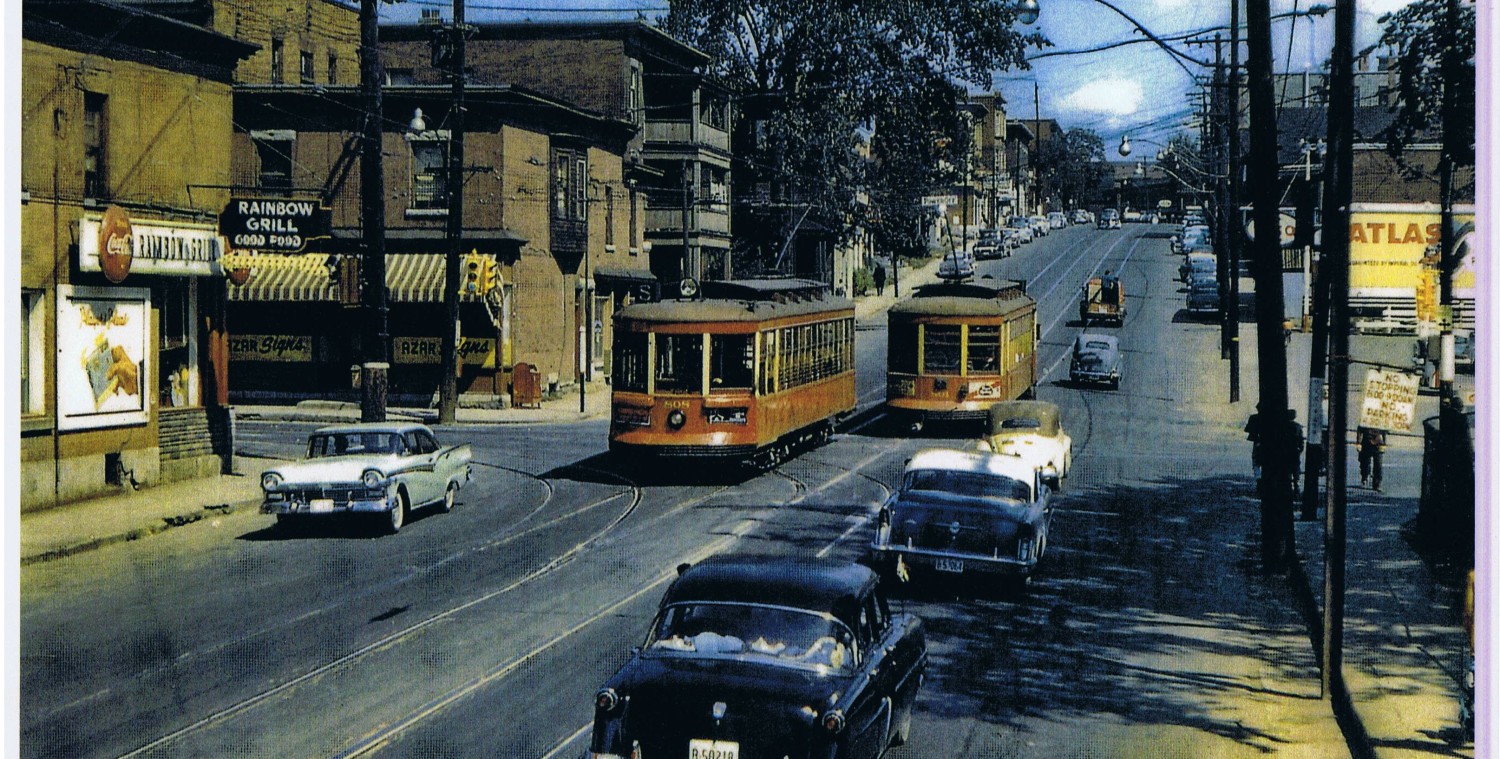
It seems to me to be a lot of effort and circuitous perambulations to get to a point that is just a few hundred feet east of where you started on Albert. For not much benefit. Here’s an historic photo I stole from Urbsite that shows what a straight line Laurier is (from the top of the hill) to the section of Albert on the Flats down below. A staircase up this hill might have been worth it, but not the circuitous one now suggested by the city, which sends one on a long detour to get to this spot. The merits of this route is discussed in http://denvan.ca/wp/nanny-goat-path/
(above: the three-porched-row house at the bottom of the concrete wall is now where Good Companions is. )
Personally, I’m not thrilled with either route. They are very uphill, only to go downhill again a block later. I consider myself an expert at finding the flat route between points. Cycling routes that don’t consider the grade, just don’t make the grade for me.
It’s much less hill climbing and descending to simply ride along Slater (if you like that sort of vehicular cycling). Or cycle up the Albert contra flow lane or even the sidewalk (I don’t mind, if you do it carefully). Both these options take you a more modest grade.
And in the City’s longer term traffic plans (ie beyond 2018), the Slater alignment will be abandoned, and Slater moved over to share the Albert right of way, which will be unnecessarily wide once the transitway is removed. There is a drawing of this realignment at http://westsideaction.wordpress.com/2012/07/12/civic-gateways-absense-of/ Logic would suggest that the old Slater right of way would make a great, gentle slope bike path along the edge of the forested escarpment, while keeping a bit separated from heavy road traffic. Sounds great to me.
Ahh, but then how to get to Laurier? Typically, you can’t get there from here.
At least, not until the bike path is constructed on some sort of diagonal through the old Tech High School playing fields to reach Laurier around Percy Street. Sigh. At least there is some sort of possible linkage, given time, will, and funding.
So, back to the staircases.
The Empress staircase has the “old model” trough for wheeling a bike up (or down) the stairs. Over on Bayview, the City widened the short concrete stair there by about 18″ to permit the installation of this trough, which comes complete with Zebra Stripes. I saw some teens riding their bikes down this trough, which would be tough to do on the Empress stairs.
But in case someone wants to try, here is the view down the Empress stairs. Navigating the bumps and chicanes at each landing merely adds a frisson of challenge to the task.
Look closely in the above photo, and you will see a cyclist approaching Mount Staircase. Do they expect the magnitude of the climb ahead of them?


Returning from LeBreton Flats nightly with a heavy bike and trailer during Bluesfest, I found Wellington-Lyon to be the shallowest route, and easier despite being longer. To do that option from Albert/Empress, you could take the Albert half of the Y, turn left onto one of the side streets (Brickhill or Commissioner) then right onto Fleet/Cliff street, Old Wellington, then Wellington (onward to Lyon)
On my bike, I brave the traffic on Slater to get to points east. then cut through the parking lot at the old tech HS to get to Laurier for points south. For the Market I take Brickhill to Old Wellington which joins up with Wellington in front of Library and Archives.
I have to thank you for posting this. I live in the little yellow house just to the right of the stairs and I sit on my patio and smoke. This year I noticed a massive increase in cyclists taking those stairs (I’d seen one or two the 3 years previous, all of a sudden I’m seeing 10 or more a day) I guess it’s because of the sign.
The dismay on people’s faces when they see what the sign has them in for is funny, in a very schadenfreude kinda way. Every day I’ll be sitting on my porch and someone will bike up and they’ll just mutter a curse word. as they get off their bike and mentally prep themselves for hauling their bike up those stairs.