


The railway cut is being constructed on the west side of Dow’s Lake; it is now the O-Train corridor.
The southwest side of Preston & Carling is a sea of temporary buildings.
On the top right, much of LeBreton Flats remains unflat.
On the top left, the first tall building at Tunney’s Pasture appears. On the bottom right, the NRCan complex at Booth and Carling is underway.
Here’s a 1967 aerial view of the temporary buildings near Dow’s Lake, just before demolition started. To the left, the brand-new Sir John Carling building, now empty and slated for demolition. To the right, the old boathouses. Take close note of how small the trees are in Commissioner’s Park, on the north side of Dow’s Lake. The park was still new, reclaimed from lumber yards. The trees are huge now, which highlights the NCC’s long term vision. The City of Ottawa would never plant so many trees intended to grow large. They would wait until all the surrounding lands were developed first before planting anything.

Photos courtesy of the Carling-Bayview CDP.
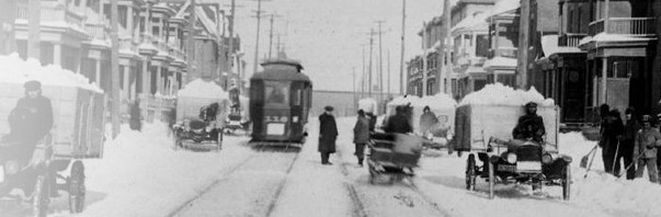
Very cool! The photo at the top is very helpful for me, as I’m leading a Jane’s Walk (or Bike in my case) to explore the lost shoreline / waterfront of the Ottawa river. This is the first photo I’ve seen that clearly shows the pre-parkway (or as you so aptly put it: the Ottawa River Commuter Expressway) shoreline West of LeBreton flats. It’s incredible to see just how far South the shoreline – and particularly Nepean Bay and the broad sandy beach along the Scott / Wellington / Albert St Rail alignment – used to extend. The City Centre and Brooke Claxton building in Tunney’s Pasture are clearly *waterfront* property in this shot! You can also see the old Wellington Street trestle bridge so this must be mid 60’s at the latest.
Do you know where an enterprising lad like myself might find more aerial photos from this set?
I have — somewhere — a really nice 11×17 aerial taken from above mechanicsville looking toward the downtown that shows all the old shoreline in great detail, before nepean bay was filled in, the POW bridge is longer over water, etc. I will try to find it amongst the hoaded heaps of paper around here.
Cool! Yes please. Thanks Eric,
The tunnel construction shot would have likely been taken 1967, maybe 1966. See:
http://www.railways.incanada.net/candate/ottawa.htm#1960
1967, May 3 – The first train to pass through the Dows Lake tunnel is a ballast train headed by Canadian Pacific RS-3 no. 8458. The tunnel is officially opened on August 5, 1967. The last train to use the old route via the Dows lake swing bridge was train 132 for Montreal via the North Shore with RDC-3 9024 leading RDC-1 9054 on Tuesday August 1, 1967. The first service trains to use the new tunnel were the Prescott wayfreight, train 94, with 8795 (first southbound) and 8575 on the a freight from Montreal (first northbound), on the same day.
I’m curious as to why a substantial building not even 50 years old (the Sir John) is slated for demolition…
It’s a “sick” building with mould and asbestos.
That bad? Truly?
Note that the big old Canada Post HQ at Confederation Heights was torn down some 15 years ago when it was less than 40 years old. Refits and upgrades often cost more than a new building. The Carling Building had nice views, but small old windows, low ceilings and narrow floorplate.
I’m willing to concede that based on current practices it might be obsolete for office functions. To demolish it, they will need to remove all the interiors, the asbestos, etc, the pipes, and the exterior skin. Why then pay to demolish the rest (ie, the floors, pillars, foundations, elevator shafts, stairwells)? The narrow floorplate is well suited to condos, and the new exterior can have lots of glass, indeed may be 100% glass. Once we demolish the Carling building, developers will simply put up a new one (condo). This is inefficient and the feds are passing up good money available by selling the bare concrete structure.
The University of Ottawa’s Geography library on the third floor of the Morisset Building has a big collection of aerial images of Ottawa from past years. The City of Ottawa Library in downtown has a spot known as the “Ottawa Room” and has loads of stuff from years past. Worth checking.