

The new Bayview Station on the Confederation Line will be built up high on the new bridge in the same place as the old transitway bridge. It will have a curbside entry from Albert Street at the east end of the bridges, roughly where a flight of stairs used to go down to the OTrain. Here’s an older vision of the proposed station, as seen from the Albert St sidewalk, which presumably is similar to what is under construction:

The OTrain Trillium Line Station will continue to be at the lower ground level, but moved to the west side of the under-bridge space, and access to it will be from the west side of the tracks.
That still leaves a lot of space under the Albert Street and the Confederation Line bridges for future LRT service to Gatineau via the Prince of Wales Bridge. And the existing multi user pathway (MUP) will continue to be along the east side of the Trillium tracks. Eventually a matching mate will be constructed along the west side of the tracks too (the first bits of that path have appeared up at Soho Italia and Envie towers at the Carling end of the route).
And that still leaves lots of space under the bridges for wider pedestrian and cyclist facilities if the Sens Arena actually gets built and all those 55 storey towers get built around Bayview Station. Recall that Trinity is starting work in January on the first 2 of those towers at 900 Albert, code named “trinity station” [not to be confusing in any way, of course] and the same firm shows a scattering of similar towers to the north of the tracks running right out to the Ottawa River as part of their Rendez Vous LeBreton scheme:

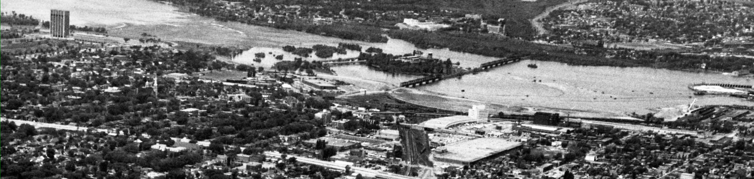
above: towers between Bayview Station (just off picture at the right) and the Parkway, also shows Prince of Wales bridge
So that space “under” the Bayview bridges will be busy and lively. I hope it gets the quality finishing it deserves.
So what happens to the MUP currently on the north side of Albert? Recall it connects to the Laurier Separated Bike Lanes / crosstown bikeway project. And a bit further west, there is the Scott Street MUP. How will one get from the Albert [east] side of Bayview Station to the Scott [west] side? [Everyone seems to agree, in rare unanimity, that the Albert overpass is dreadful and unsuitable for walking and cycling].
The City is proposing a new pedestrian and cyclist passage under the tracks just east of the new Station (there are similar underpasses at Ottawa U Campus and Pimisi Stations). This would connect the Albert pathways with the Scott pathways by going around Bayview Station on its north side. Here’s a crude drawing of the interim path layout that also shows the proposed underpass (don’t try to read all the orange signs, they’re for the route that opened two days ago):

above: new Bayview LRT Station is over the Otrain Trillium tracks where the fine white print says “bayview station work zone”; the new entrance to that station – shown in the previous illustration – will be roughly where the pathway is labelled MUP No.6, and the underpass is shown as the white rectangle with four legs
__________________
As cyclists and pedestrians well know, the current Bayview Station bus stops are at the crest of the hill that carries Albert up and over the rail tracks.
Facilities such as these are of course designed by traffic engineers, who in my experience are somewhat motor traffic centric. To them, the hill over the tracks is inconsequential, just depress the pedal a bit more and accelerate over the rise. Cyclists and walkers are aware of the hill, the effort required to ascend, and probably vaguely aware that the hill is an artificial construct for the convenience of motorists but pedestrians and cyclists are allowed the pleasure of climbing the hill merely to descend it again.
Puff puff.
We should be in better shape.
I estimate the hill is about 30′ high (3 stories high) compared to Bayview Road or City Centre Avenue. If we allow for a 11′ high clearance in the proposed new underpass … and 4′ of gravel ballast and roadbed above that to the LRT tracks … then the floor of the tunnel will be only 15′ above the flat … and we will have cut the hill in half.
Only one puff, instead of two.
Fifteen feet less hill for a motorist isn’t noticeable. But it sure is for a cyclist or pedestrian. Especially newbies, casual cyclists, and the less fit. It will make the western cycling route and pathway much more user friendly, even for those super-fit folks commuter cycling to and from Kanata.
Of course, the vision of a flatter path is merely one option.
The City could equally well decide on a “value engineered” (ie, cheapest) approach, which would build the new underpass but access it via a slope down from the crest of the hill, rather than cutting off the top of the hill to make the approach flat. This would save a few dozen truckloads of dirt and maybe some retaining wall too, so its bound to be looked at lovingly by bean counters. Users could then enjoy ascending the full 30′ rise of the hill, and only then descend to the underpass level.
Descending to an underpass is dicey to design, since humans tend to exhibit some natural reluctance to enter holes or entrapment areas. Compare the Campus underpass to the one at Carleton Station. Which one is inviting and feels safer? Which layout would you want at Bayview Station?
Now if the city held consultations on station design they’d get input like that from citizens. And we’d end up with a better, more useful and used station environment.
_______________
Whether the underpass approach is flat or not, the proposed final pathway configuration has a number of nice features:
- it keeps east-west through traffic pretty much on a straight line, albeit with a jog at each end to get to the station or bayview road underpasses
- it puts fewer uses competing for the limited downslope space between the Confederation right of way and Albert Street
- it eliminates some of those confusing jogs in the pathways at the Trillium level
- it means the east-west path (remember Bikewest?) intersects the Trillium north-south pass with a simple + in a open space just north of the station
- it separates the station access functions from the through traffic functions to the benefit of all
- the Tom Brown MUP (recently closed during construction) will provide easy flat access from West Wellington to the new Station via the lower platform level and with direct access to the east-west and north-south pathways
_____________
Note that while this pathway design and underpass is a good medium term solution, there are still other complicating issues to address in the future, including the replacement of the MUPs with complete streets (which put cycle paths on either side of the street) and what happens to the east-west link if the Trillium Line goes to Gatineau over the Prince of Wales Bridge.
Incremental, staged solutions are appropriate here because there are so many known-to-be-unknown things here: Trinity Station with three or four 55 storey towers and retail, the Arena sending thousands of people to the station late at night, condoland, Bayview Yards innovation centre, etc.
I find the station design very attractive, but can’t help but wonder how it is going to work in the winter.
…and i hope they put gutters on the edge of the roof that leans/drains towards the Bayview train access before people complain about it..
I had a similar thought looking at the images of Pimsi station. The angled roof creates a snowfield which will déboucher sur both railway lines. Get a foot of heavy wet snow exiting the Pimsi roof and I expect the resulting snow wall will create problems with train operation the next morning..
Bayview appears to have the same problem except that at Bayview the snow slides laterally and the snow dump will lie along the length of the tracks rather than create a transverse wall as appears likely at Pimsi.
About the two towers they are building: http://www.trinity-group.com/property/albert-preston/
Is it all approved and everything? The residential part, do you know if it’s rental or condos? Do we have pictures of the top of the buildings? 🙂
Caio: the details of Trinity Station are still being worked out. Count on two 55 storey towers, rentals, in partnership with a major ottawa developer. Site work begins in January, with foundation excavation starting in june 2017. The third tower, whether apt, condo, or office, follows. There are as yet no exterior elevations of the buildings or retail; the pic on the signs are just for illustration purposes. Recall excavating those railway turntables? That was part of the site prep work.
You guys stole all of my comment ideas! I, too, was wondering how it will look in February. I have often waited for the O-Train on cold winter days and have taken the time to notice the splash of salty slush from the flowing river of buses, the strong, ice-peppered wind that creeps in from any direction, and the snow drift buildups against any vertical surface. Will this glass wall offer protection or simply channel more wind onto unsuspecting waiting passengers?