


The two current LeBreton Flats proposals are not on islands — they abut existing or proposed city spaces on all sides. How well do the proposals play with their neighbours?
To the North, the Zibi plans are approved and under construction. They seem compatible with whichever proponent “wins” the right to proceed. Windmill, Zibi’s owners, are part of the Rendez Vous (RV) Sens applicants. Both applicants want improved access to the northern riverfront lands; RV was the most aggressive in crossing the (dotted) red line of sacred do-not-touch NCC property to propose several at-grade crossings to get to the River.
To the East, the two bids front onto Booth Street. The other side of Booth was awarded to Claridge some years ago, and they are steadily building out units to meet market demand. While much maligned by “drive by planners”, the buildings have good exterior materials (lots of brick), interesting shapes and spaces and encompass many trendy urban planning memes. I fully expect Claridge to apply to build (many) taller buildings on their remaining lands and to downplay the large number of townhouse units currently in the approved plan. They’ll cite changing times, proximity to Pimisi, etc. Indeed, the RV model showed the Claridge property like this, with taller-than-now-approved buildings:

(Claridge’s lands: four foreground buildings are built; the four remaining towers and townhouse units are roughly per the original plan shown at the end of the story. The swirly green plot is actually Fed lands designated for two 11 storey office towers — the landscaping is a temporary, bold, drive by experience. Notice the fanciful greenery down the centre of Wellington St and its vacuous south side.
I have no doubt Claridge will get approval to build taller. Someday we will look fondly at the mostly low rise and podium style of the just-built units. Built with actual brick exteriors.
To the West, there is the OTrain Trillium corridor, and beyond that, Bayview Yards, which the City used to avow would “show the NCC” the better way to build urban communities. Before the City was mugged by reality, and discovered it couldn’t actually afford to build 5 story apartments. Indeed, it has been unable to build even the 25 storey ones it decided on. It couldn’t even put in a donated Sens community ice pad. The site escapes public scorn because it isn’t highly visible from adjacent highways. The cost of undevelopment doesn’t show up on the City’s books.
RV group proposes a new street running east west through their Flats and over the tracks to connect to the Bayview Yards. I highly approve. It help knits adjacent residential areas together that are badly cut up by transportation corridors and wastelands.
Mainly on the south side does LeBreton Flats come up against an existing neighbourhood. There is a significant vacant lot at the southwestern corner, by City Centre Avenue, that Trinity Developments, the major backer of RV, already owns and has approval for high rises, and for which they are negotiating higher rises. They can be seen in the picture below at the far left, by the neck tie.
The RV group model showed proposed higher rise buildings on the adjacent lands, which made their model fit better into the context.

Along Albert, a number of the RV buildings have lower-rise podiums with the high rises set back a half block. The corner of Booth got a “gateway” tower which looks out of scale.
The Devcore model rendered all the surrounding lands as flatlands, which makes their higher rises look more starkly aloof. They also have no significant setbacks or podiums.

The north edge of Albert is a mess. The 1980’s phase 1 LeBreton development (by CMHC and NCC) turned its back to the Albert transportation sewer. The high sound barrier walls have been reduced in height in the last few years, but the north side is still unappealing. The houses of Walnut court back onto Albert at a six foot elevation, making any future integration very hard. The next apartment building — a seniors residence — at Preston actually has a usable door facing Albert, which could be improved.
All of the block from Preston to Rochester is Ottawa Community Housing, elevated above the sidewalk level and fortified with concrete block walls. The City recently re-mortgaged these for another 35 years (rolling over the unpaid previous mortgage into the new one…) but there is little expectation they will outlive their mortgage. More likely, at least some will be demolished well before then.
The average house in North America has a 50 year life expectancy, before it is obsolete and demolished, or replaced, or converted to something else. * Rental housing projects have a harder life, and early death. Public Housing projects have an even shorter life span.
The City has already told LeBreton Flats proponents it will replace (some of?) these stacked townhouses with apartments, facing the road, someday. They already rezoned the first bunch for this in 2015. (If you live there, don’t panic, the city moves slowly. Very slowly. Very very slowly. You are more likely to die of old age than get evicted. )
This will smooth the gradient between the four storey heights along Primrose and the rest of the neighbourhood, upwards towards Albert. A few new nine storey buildings, coupled with the two existing 5 storey ones, will ease the transition to the taller ones proposed for the north side of Albert on the Flats, and return the street face to something more normal.
There are also CCOC townhouses in the Rochester to Booth block that have front doors at street level, but hidden behind a yet-to-be-demolished brick wall. The CCOC property, including the bright red brick apartment building at the corner of Booth, could easily be modified to “open up” onto Albert and create a more active streetscape.
East of Booth, there are already bits of original 1902 housing facing the street, and then there is the Good Companions Centre, struggling in its old building that sits on a very large and redevelopable lot. Just ripe for a mixed-use building. The City is conveniently installing new sewers and water lines this summer on Empress. Alas, the City missed the opportunity to rebuild the street as a naked street, wonerf, or pedestrian priority zone. Our foresight is so selective.
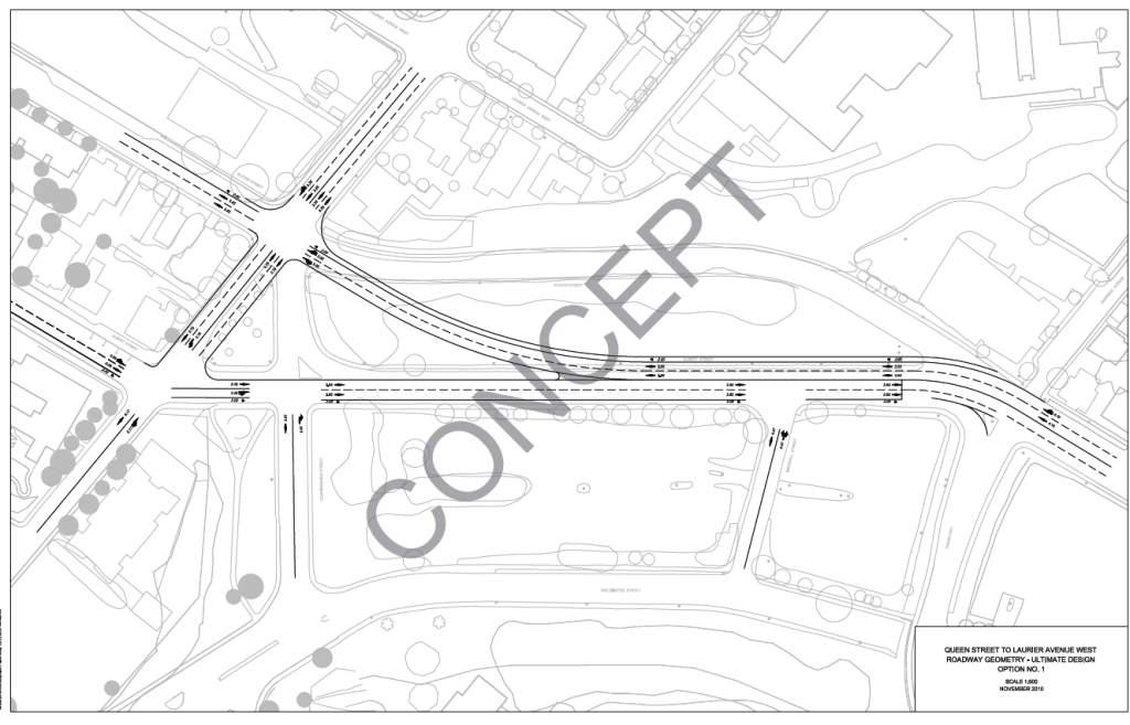
There remains one adjacent bit of neighbourhood that is neither “existing” or in play. Those are the lands along the north side of Albert from Bronson to Booth. Some are city owned, and it approved “The Escarpment Plan” a number of years ago for 20+ storey apartment buildings along that strip. Some is NCC owned, which of course the city has designated as Parkland, rather than give up some of its own space. Keep in mind that the Bronson-Slater-Albert intersection will be rebuilt, perhaps more like this:
and there all those wonderful ideas for a new Central Library edifice either at the CON in the picture above, or on Albert at Booth per the RV and Devcore proposals, all three featuring possible indoor connections to Pimisi Station.
In short, there is potential to transition and integrate the urban fabric from south to north along Albert over the next 25++ years its takes to build the Flats. And in 2018, the city has contracted to refashion Albert into a complete street, like Main or Churchill, with cycle tracks and even a few (very few) trees. Both proponents for the Flats, RV and Devcore, show Albert returned to its four lane status. Mind, city traffic engineers may yet take another whack at this.
Residents living south of Albert, in the Chinatown and Little Italy neighbourhoods, have long complained about a lack of access to the NCC riverfront parklands. In 1964, the NCC went so far as to remove the river and push it further away, by filling in Nepean Bay with toxic waste that now has to be dug out again at guess-who’s expense. The aqueduct running through the Flats has several restored heritage bridges, but the City or the NCC has closed off several of these “for soil remediation”.
Recent City reno’s to the Bronson-Commisioner Hill further make it difficult to go north towards the parkland. Empress and Brickhill no longer provide northward access, being left cut off by the deep and open LRT trench. Booth is closed; the Bayview MUP to the river closes at the end of February for 2 years, and the Preston extension is only temporary and will close next year. At least the 95 bus is closer now, for residents to take the bus to Dominion Station and walk to the river from there.
The new LeBreton Flats proponents do provide some (someday) riverfront access. Because it decks over the LRT line, RV provides a bit more connection from south to north; but Devcore also shows a mid-canal new ped bridge. Both plans leave Wellington in front of the War Museum and the Sir JAM parkway (ie commuter expressway) as is. Which is too fast, too freeway like, and effectively cutting off the old and new residents from the River.
Unfortunately, RV leaves the south side of Wellington as a linear park / wide boulevard, to facilitate views from their event centre to Parliament, at the price of Wellington remaining a too wide too bleak too fast no-go zone. The NCC needs a very serious rethink about Wellington at the Museum and Sir JAM as far as Sliddel or even Parkdale. Something closer to Sussex Drive, and less like the Queensway, would be nice.
Any bunch of new plans dropped down on or near existing neighbourhoods is going to elicit squeals of anguish. Too tall, too dense, not compatible, not enough greenery, not enough whatever it is that might serve to derail the project at hand. The RV plan meshes better with adjacent neighbourhoods than does the Devcore plan. Both need improvements.
_________________
*The average house in North America has a 50 year life expectancy, before it is obsolete and demolished, or replaced, or converted to something else. * This is a factoid lodged in my pre-Alzheimer brain cells. Maybe someday I’ll remember its source. It is perhaps more applicable to the bulk of pre-1970 urban areas, since post-1970 segregated land uses became the municipal gospel, so redevelopment is less organic and more rigour mortis. The original vibrant community of kind, loving wonderful people who lived on the flats, to be expropriated in 1963, lived in houses built post-1902, so 60 years old max. My own house is on Primrose, is about 114 years old, and a total money pit of repairs and renewal and will never be energy efficient or carbon neutral.
______________________
the approved build out for Claridge at LeBreton is shown below. They already got four stories added to the triangular building closest to the aqueduct:

Overall I see some merit in both proposals that we can live with which are an improvement over the existing vacant site. My preference would have been a development closer to the Montreal Expo 67 site or the Chicago Millenium Park site with more pavilions, public parks and pedestrian connectivity to the Ottawa river and downtown. I guess private developers need some return on their investment with more high rise condos and commercial advertising space.
Both proposals could be improved by increased pedestrian connectivity ( bridges) to the Ottawa River and downtown. Berms could be constructed to reduce traffic noise from the SJAM and Booth Street. More local shopping and community – daycare space should be provided ( perhaps it is there I just did not see it).
I would also like to see some form of quiet Spiritual -worship space for those who are tired of all the activity. There are proposals for pavilions for hockey, beer, innovation and communication why not one for spirituality and religion