

Over the next few stories, Richard Eade and yours truly will be looking in some detail at the proposed reconstruction of Carling Avenue from the top of the hill by the Farm, down to Sherwood Drive, to Preston, Booth, and up the other hill to Bronson.
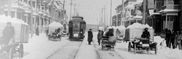
Carling is today six lanes, three in each direction. Buses going eastbound are now in the right curb lane. The #85 has to shift from the right curb side at Trillium crossing to the left lane to get onto Preston. This can be tough. And most transit passengers have to cross six lanes of traffic to get to their destinations.
The city proposes to move the eastbound right curbside bus movements into a new lane built down the current median, jumping the queue at Preston and avoiding the right-turning traffic on Carling all the way up to Bronson.
First, Eric’s take on the segment around Sherwood Drive.

Buses coming down the hill from the Farm (on the left, in the drawing above) will be in a marked bus lane (which will not be painted red, that is just for illustration purposes on the drawings).
Cyclists, which I guess were “sharing” the bus lane (play nicely with those big buses now…) get a new cycle track starting just before the Sherwood intersection. A cycle track is a asphalt bike path above the curb line, along side the pedestrian concrete sidewalk, like on Churchill or Main St.
The City’s revised Sherwood Drive intersection appears to offer needed cycling improvements which will yield significant safety and convenience to cyclists, pedestrians, and motorists (motorists benefit by knowing where to expect cyclists).
I expect the city will install traffic lights on the cycle track bypassing the intersection on the south side since to allow cyclists to skip the red lights would be … what? unsafe? unsporting? reflect real world behaviour?
But, the westbound cycle track on the northwest corner is too short before it disappears into the general traffic and bus lane. Alas, this is typical of all the city’s merges of cycle tracks onto general traffic lanes. Scary to use.
There are bus stops at Sherwood, but fewer of them between Sherwood and Preston. The new, fewer, bus stop locations mean a longer walk to transit for residents on Champagne or employed at the CMPA complex, which may adversely affect transit attractiveness.
As the eastbound buses cross Sherwood, probably on their own exclusive green light, they will move left over to a new bus-only lane. Unfortunately there is a odd weaving movement for motorists as one approaches Champagne intersection. It looks like the median gets a lot narrower too.
![]()
It’s never quite clear in the City’s drawings what becomes of the currently weedy green patch of median, but most likely it will become too narrow to conveniently leave green. (More on this later.)
Now, here is Richard Eade’s analysis:
My first thing is to have the east-bound buses transition from the outside lane to the median further west than the City plans; specifically, running down the hill between Maple and Sherwood.
The City’s planned transition from the outside bus lane to the median is very short. Yes, there is a Transit Priority Signal at Sherwood that will allow buses to move across the two traffic lanes before traffic gets to move – but that only works if all traffic is stopped at the signal every time a bus is coming; and remains stopped during any dwell at the bus stop.
It would be possible to embed a trigger in the bus lane coming down the hill to change the lights for every bus, but that also means that every bus would also get stopped at the intersection. I believe that a far more sensible plan is to transition the buses west of Sherwood, as illustrated in Figure 1.
![]()
This would require the modification of a short section of the median west of Sherwood. However, since it would remove the need for additional property, the funds designated for the property purchase could be used for the median modification. It also gets cyclists out of the bus lane much sooner, as detailed in a drawing further down.
Second, I would like to see the intersection of Sherwood and Carling changed to a 90° angle, or close to it.

I have included the property lines in the above graphic of the current configuration to show that the City already owns the required property. Yet, the City is planning to leave the intersection as is, with only peripheral changes; including taking additional property from the park edge.
Here is a sketch of what a 90 degree intersection could look like. It greatly shortens the pedestrian crossing distances, avoids the acute angle turning movements, and bonus … makes it more difficult to extend Sherwood through the hospital site over to Prince of Wales.

If the East-bound buses moved into the median before reaching Sherwood, then the east-bound stop could be moved into the median, just east of Sherwood. (More on exactly how these median bus stops will work is the subject of the next story).
Notice that with the buses in the median, there is no requirement to take additional land from the park; although the paths in the park could be realigned to the intersection if desired.
In Figure 5, the 6-pack of cars in the top right was left to show where the current west-bound Stop Line is (refer back to Figure 2, if needed).
I have not included the City’s planned changes for the west-bound (north-side) of Carling in figure 5, although I would expect that they could be similar to what is planned. That said, I notice that the City Plan appears to make use of the sliver of property at 899 Carling. Refer to the top right of Figure 2 to see the property line. If this property is included in the road plan, then it can no longer be used for parking and might render Anytime Fitness unable to meet parking requirements. It is possible, however, that the required roadway changes can be contained within the existing Right of Way; since there is currently a narrow cobbled buffer between the sidewalk and the parking. The provided diagram is not clear on this point.
Returning to my suggestion of realigning the Sherwood intersection; this would allow for shorter crossing distances for pedestrians and cyclists; and squaring the intersection creates new land at the north-east of the intersection.
___________
Note to reader: the city will, of course, object that the proposed intersection changes are “not in the budget” or beyond the scope of the current plan. The city typically comes up with their version of a proposed works, costs it, sets the budget, and then asks for public opinion with the convenient “out” that anything different or better is not in the budget.
Next: from Sherwood to Preston …
_____________
Note: if you are wondering what a median bus way looks like, here are links to two sections of the two-way median transitway on Chapman Mills here in Ottawa:
Another half bsked plan by city road/traffic planners that have failed badly on past attempts. Just look at Main St in old Ottawa East.
I biked on Carling once. It was a terrifying experience I have never repeated so I welcome the segregated lanes. I just wish they continued westward up the hill . Do you know if the long term plan is to do so?
Sherwood is a weird intersection. I think squaring it off makes a lot of sense.
Actually i think the city and farm and ncc and hospital should be looking at a bidirectional MUP on the south side, from dows lake road to merivale, modelled on the river and canal pathways. This suggestional has received unremitting hostlity from city cycling and road staff, so dont hold your breath.
Shame, because that would be far more attractive than biking or walking next to buses and speeding cars…
In discussion with the consultants working on the Bank Street Cycle tracks, they made it clear that where they can provide 1.8 m between the vehicle lanes and the cycle tracks at intersections, the cycle lanes can be treated as a separate roadway and cyclists would not be required to stop. The 1.8m is the space required for a wheelchair to wait. Cyclists would have a yield line before the crosswalk where it continues across the roadway.