
 Richmond-Byron Options")
If the western LRT does not go via Carling Avenue, there is a whole set of options in the Richmond-Byron corridor, shown below:

The Churchill-Richmond option had a fatal flaw: too sharp a turn at the corner of Richmond and Churchill. The McRae-Richmond option required redoing the Westboro Station and then entering a short sharp S turn, something that engineers love — NOT. Another McRae option put a President’s Choice station at Loblaws and then turned west under Byron. That tunnel section would have emerged just west of the Westboro Station condo development. Here’s what is left:

The Churchill-Byron option digs cut and cover tunnels under Churchill, and turns “at the top of the hill” (but really underground, so there is no “hill”) which requires taking out the laundromat there (call out the heritage buffs). All of the options following use some part of Byron. More details of how that might work along Byron are several slides down. The cut and cover tunnel under Churchill and Byron would come out just west of Westboro Station condos, which would have a station called … wait for it … Byron Station. Am I alone in thinking we may need to rename some stations in this area?

The slide below shows another option at the western end of the Byron route, taking it up to Carling via a cut and cover tunnel under Woodroffe. This has the merit of serving Carlingwood, a major destination now and intensification area for the future.

All of the above options turned south from the existing transitway trench. There is one option that uses all of the trench, all the way to Dominion Station. Dominion Station would have to be realigned a bit as the LRT would turn west at Dominion (this realignment is pretty easy, as the station is merely two bus shelters; but the new station would be heated and have a grade separated ped and cyclist crossover). This option does NOT take out or change the current lanes of the Ottawa River Commuter Expressway. Rather, the LRT somewhat follows the south side bike path a short distance to Rochester Field.
Rochester Field is currently a vacant lot. It is not part of the Parkway. Negotiations are under way to sell it to the City. Parkland is apparently so scarce and valuable in the leafy McKeller Park area that the City is seriously considering putting the LRT in a tunnel under the park in order to preserve parkland and access the south side of Richmond. No such respect is being offered to Dalhousie or Hintonburg residents who are being offered an open cut which cannot be covered over “due to the expense”. Plus ca change…
There are two options as the line goes west along Richmond. One follows the sosuth side of Richmond Road all the way to Lincoln Fields. The other deeks up Woodroffe to hit Carlingwood before heading west. I have yet to see a layout of how the line would get off Carling and still hit the existing Lincoln Fields station alignment. I suspect that the need to angle the line north off Carling, then sharp south (a turn of about 110 degrees) while simultaneously rising from the Carling median up and over the westbound Carling lanes and then down to enter the station and go under Carling Avenue … will be a problem. Even if engineerable, will riders like the corkscrew motion?


The City has a nifty sketch showing how the LRT might tunnel under Rochester Field, you will see it a few slides down.
A variation of the above line uses a longer stretch of the River Parkway lands. The LRT would run along the south side of the Parkway almost to Cleary. It would then tunnel under Richmond to a point just beyond Woodroffe, and run on the surface after that. These options utilize the straight line to connect Dominion to Richmond (which makes for faster trains, which means less cost to construct and operational savings forever). Conveniently, the engineers have managed to keep all the stations above ground, which should please their budget masters and their customers .

I was really impressed by how well the LRT works out along the Richmond-Byron stretch. The consultants realized that Richmond is three-four lanes in the middle, but only two lanes at each end. So they put the road on a diet, and made it two lanes all the way. It would become less like a highway and more like a street. They then snuggled the LRT between Richmond and the dog-paths in the linear park. The result: no major loss of trees; a calmed Richmond Road; a refocused Byron Avenue that serves adjacent residential streets and less of a parallel raceway to Richmond Road; and fewer streets crossing the Byron linear park, making it a better neighborhood park.
Only at the stations would the LRT facilities creep into the linear park, but these could well be assets rather than detractions. Sorry for the small pic below, but squint at it long enough and you can figure out the details. On the left, pic 1 is LRT track between Richmond road and the linear park; pic 2 shows a station. Pic 3 and 4 show the tunnel section, which would be built using cut and cover, so there will be (temporary) tree loss.
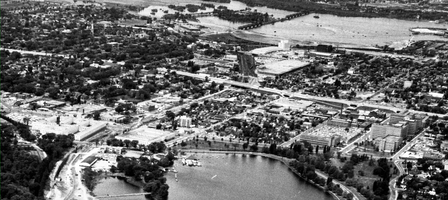
On the top right (of the picture below) the LRT train leaves Dominion off to the left, passes in front of the office building and Keg Manor, and angles into the tunnel under Rochester Field, later to emerge between Richmond Road and linear park. The last pic at the bottom right shows a train stopped at a surface station along Richmond Road.

Next: the (dreaded) Ottawa River Parkway options.
Too few stations, too far apart. Why bother expensive engineering solutions (tunnels, elevations, etc) to bring the LRT closer to new/growing population from the River if the train isn’t going to stop anywhere near much of that new/growing population? Tunney’s and Westboro stations are too far apart as it is, and this distance seems to be the benchmark for the new section. I think an urban transit system should have stops every 600-800 metres not every 1.2 kilometres. Same problem with the removal of three of the four stops to be skipped in the downtown core (I don’t think losing Good Companions/Empress, just metres from Lebreton Station will be a great loss once the Lebreton/Escarpment lands in between are developed in, 2375?).
Instead of keeping Dominion Station, the options using Rochester Field should have a station closer to Richmond Road instead. This would serve Westboro village better, as well as provide an opportunity to transfer to buses (it could eliminate the annoying McRae-Scott-Churchill detour the #2 bus makes to Westboro station).
James: This is supposed to be Rapid Transit. For local stops, there’s always the #2.
I really like both options that hit Carlingwood. The turn from the Transitway onto Carling only looks like 90 degrees to me. There’s no need to retain the existing station platforms at Lincoln Fields: that’s an ideal intensification area.
Brad-I’m sure they said the same thing about the #18, which will no longer fill in the gaps between Tunney’s and Westboro.
Eric, thanks for posting these, it’s very intriguing. I grew up half a block from Byron in McKellar Park and would have very much enjoyed rapid transit so close to home. However James makes a good point that it’s no good having the train go by if it doesn’t stop often enough. When will City of Ottawa transit planners get it in their heads that not all routes have to be scheduled to stop at every single station?
I think two new stations between Lincoln fields and Dominion is enough, although I think it would be nice to move Dominion station closer to Rochester field and Richmond Rd.
If they can do the majority of the Byron section at grade with a minimum of disruption that is very good news as I think it then has a chance to compete on cost with the Ottawa river expressway route.
I’m inclined to agree that LRT shuld be rapid transit, with bus between stops to serve local areas. Stopping every 500m or so is chaotic.
Ottawa already has a problem of excess complexity (What are the start and end points of the 95 bus? “It depends” is a ridiculous answer, but is the current status quo). Adding “Train A stops at alternate stops; train B stops at all stops; train C stops at stops whose names end in a vowel, except for Y” just adds unnecessary complexity to the system; far better for the system to have all trains going to all stops. making the system easy for all to understand.
sigh. why do debates have to go this way so often? I think that 1200 metres between stops is too far (Charles is bang on about the eventual fate of service in-between, IMHO), and I suggest 600-800 metres would be a better model (e.g., like the Montreal Metro), you come back with “Stopping every 500m or so is chaotic.” Who are you debating?
must re-iterate that I think 600-800 metres should be the model for urban segments of the system, i.e., with (or soon-to-have) high density of residents and jobs. Obviously a stop every 600 metrest on the current alignment from Hurdman to Blair would be pointless, but in a corridor like Wellington-Richmond (or Montreal Rd, say), people and businesses who are located right on that corridor shouldn’t be more than 10 minutes walk from a station (otherwise it’s all disruption and no benefit, all pain and no gain).
James has got quite a valid point. Tunney’s and Westboro are 1.6 km (a mile) apart, not 1.2 km or 1 km. That is one of the largest distances between two Transitway stations (i.e. on a Transitway) anywhere (a couple of others of the same distance are Cyrville-Blair and Heron-Walkley, neither of which are in areas anywhere as developed as Tunney’s-Westboro).
It is also worth pointing out that Westboro Station is in the wrong place. It was put where it is due to a BRT design requirement – an expansive wide station with an access ramp. Westboro Station is located where there was a lot of spare space, not because it was a good place for a station. None of this is needed for LRT and since we’ll be demolishing the station anyway we can just as easily put it somewhere else. The proper place for a station serving Westboro is at Churchill Avenue.
That location, naturally, has some knock-on effects. For one, it makes the Tunney’s-Westboro distance even greater. We can resolve that by inserting a station at Island Park where it will be better able to serve infill condo projects, dubious and otherwise, in the Island Park-Richmond/Wellington area. It also moves Westboro Station closer to Dominion Station. That can be resolved by moving ‘Dominion’ (which would now require renaming) somewhat further west, probably to the area behind the building shown in the last image Eric posted, depending slightly on which route is chosen.
My suggestion
I like your suggestion. Since we’re building long platforms, for long trains, I’ve always thought we should be looking to locate the stops between two streets (exits at either end to each street), rather than at one street. So Lebreton would be between Booth and Preston, with direct access from both streets. Tunney’s would be between Parkdale and Holland. A new station would go somewhere between Banting/Northwestern/Carleton and Island Park (exit east for the Mosque and Wellington West, exit west for Ashcoftland). The current Westboro Station would be renamed, and new Westboro Station would be added near the condo of the same name. And definitely two more stations between there and Lincoln Fields.
Triple-tracking could allow express trains to skip “local” stations during peak times if people are really concerned about a couple of minutes on the trip from Lincoln Fields to Rideau for stations that serve vital and growing population/business districts.
I have used metro systems with local/express trains in other cities. It takes a minute to figure it out the first time and then after that it is fine. The express trains stop at every 4 stops or so and all stops downtown.
So with the current stops on the transitway, if I was commuting from Kanata then it might stop at Lincoln Fields, Tunney’s and then downtown. If I want to stop somewhere in between, either I take the local train from Kanata or I take the express train and then transfer.
I like this idea.
The stops should be more frequent where justified by density. Why is there no stop planned at Gladstone along existing O-train? Call it the Bambinos stop…
I agree with the criticism about station spacing. Tunneys, Island Park, Winston-Churchill, Westminster-Wavell, Woodroffe(Compton to Allison) might make more sense. Lots of traffic sources within 400m of the stations. And Carlingwood would be 500-600m away, while maintaining the straight line that the planners love.
On those straight lines, isn’t that less of an issue when the station is near the curve. You have to enter and leave the station slowly anyway so you’re not introducing a new slow-down and speed up to the overall route, just making a slow stretch a little longer. If they wanted to get closer to Carlingwood/Fairlawn then stick the station under the SE corner of the Carlingwood parking lot and start the big turn right afterwards. That might be the best case scenario for a big curve. Big curves at the midpoint between two stations would be the worse case.
Given how the LRT in these scenarios travels parallel but offset from the main commercial/retail street in the area, there will probably be significant N-S pedestrian traffic in the nearby streets, walking the gap between the transit corridor and the activity corridor. I wonder if anyone has considered the opportunity this would present to residential land-owners in the area. Are they going to rigidly stick to purely residential zoning on these side streets or are they going to designate some for gradual organic conversion to new uses (restaurants, boutiques, etc.).
Regarding going to Carlingwood, a possibly better option than going under Woodroffe would be to go under Lockhart. That would make it easier to build a station directly serving Carlingwood itself. However, we would also lose immediate access to the apartment blocks at Ambleside at considerable expense for what is probably not a lot of gain in the long term given that there’s supposed to be a secondary line on Carling anyway.
there will be a subsequent post on the secondary line.