A lot has happened on the new multi-user path (aka bike path) being constructed along the east side of the OTrain from the Ottawa River to Young Street, which then joins the existing path that runs further south to Carling Avenue.
Someday, I might get to put up all the in-progress pictures, but here are some showing the state of the new path as of yesterday. We start at Young Street / the Queensway, and work north to end up at the Ottawa River near Bayview Station. Path is due for completion just when the snow flies.
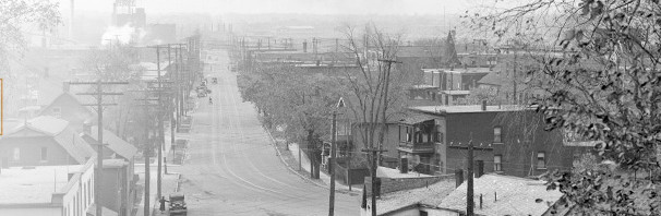
This phase of construction begins at Young Street turning circle, where the connection west is via this narrow overpass over the OTrain cut. A new bridge is planned a bit further south, at Hickory, but alas the City thus far is presenting us with a narrow bridge there too.Looking further south, along the NCC section of path going to Carling Avenue. This section also will be rebuilt and paved in the next few years.From Young Street, looking north, under the Queensway, the path uses the underpass originally built to accommodate the Champagne Freeway. The drainage in the area has been repaired, and the landscaping will be constructed to make this a less dark and unfriendly area, with protection from people who sometimes lurk on the slopes on the Qway.on the north side of the Qway, the informal parking lot used by St Anthony Club has been levelled and given topsoil in preparation for seeding. Large boulders are used throughout the project to keep cars at bay.View from Gladstone Avenue, looking south (back towards the Qway). A city works yard is on the left. The shrubs along the fence has been cut back, but not dug out, so this fence line might be quite green again by summer. On the insistence of the PAC (public advisory committee) clusters of rocks are installed as rest benches for peds and cyclists.The view north from Gladstone, where the path goes behind the large “Oak Street” government warehouse complex. With the dense undergrowth cleared out, and pathway lighting, the area is transformed.Looking south from the Somerset Street viaduct where it goes over the OTrain tracks, the new path is obscured by the piles of dirt from the trench opened up to accommodate the ductwork for the pathway lighting. On the left is a gentle slope up to the level of the Somerset viaduct, where it will join the existing eastbound bike lane on Somerset.The new slope down from Somerset viaduct to the new pathway. There may be a pedestrian shortcut installed to the right to get to the path for people walking northbound to Bayview Station.Looking north from the Somerset viaduct towards Albert Street and Bayview Station. The area behind City Centre has been transformed by cleaning up, and shouldn’t be intimidating anymore.The north side of the viaduct is a concrete retaining wall. It has been much patched and spalled and graphittied. These workers are “roughing up” the wall in preparation for spraying it in gunite (concrete the consistency of porridge).The new bike underpass is in the foreground. It is being given additional coats of waterproofing. The OTrain underpass is in the background. It’s walls were sprayed in gunite a number of years ago.Looking south from Bayview OTrain station. The path will come up to the station just by the ticket vending machine. It will run very close to the fence along the track. The bottom of the slope has been excavated in preparation for installing a precast retaining wall, the pieces of which lie scattered on the ground just to the left outside the picture.The view north from Bayview Station, towards the Ottawa River Commuter Expressway, now known as the Sir John A McDonald Parkway.Cyclists along the current River bike path see the new path start near the Prince of Wales railway bridge. The backhoe in the pic is digging holes for new trees being planted along the new path.
While I couldn’t be happier about this project in general, I have a sense of foreboding about the existing southern part of this route (south of Young St.). While a simple paving of the gravel portion would be welcome, I’m nervous about how much excavation, tree-removal, landscaping etc. is going to be deemed “necessary” to make it “safe”. It’s so pleasant right now…
Agreed
To have a general sense of foreboding is part of our human survival instinct, honed by years of dealing with (city) bureaucracies. I share your vague alarm. The old path certainly looks like it could be easily excavated 18″ deep, add gravel, top with ashphalt. And the trees are already set back the required 3 or 5′ from the path surface … but they will run in a lot of equipment to do this, which may cause the removal of overhead tree branches. And if there is to be a ramp down to each of the side streets, they have to excavate a slope etc etc.
Certainly the description of the current MUP phase called for selective tree removal and brush trimming but comes close to clear-cut — although, as they do the job, the spacious and open pathway will seem more user friendly and safe so I appreciate the severity of the cutback.
And all trees left behind by the works crew will be in double jeopardy later, when the OTrain cut is to be widened south of the Qway(in the year 2525 maybe) – those trees that dont “fall into the hole” will be severely pruned back at 45 degrees to the rail so they can’t fall into the cut or drop branches on the rail (think ice storm here).
I walked around the MUP section behind City Centre over the weekend, and was pleasantly surprised to see how much the area- especially under the ramp- had been cleaned up. Once the path is completed Art-is-In could have a very nice seating area in the back.
Too bad it will be all torn down to make room for office towers.
As a long time business tenant of the city centre complex, I too am astonished at how well and easily it cleans up. The owners are doing their bit too – patching asphalt and new drainage pipes and scuppers for the upper deck. At the PAC, we recommended the landscaping include boston ivy planted at the base of each pillar, so that within a few years it would be a leafy green wall like a giant arbour. Dunno if that will happen with city plantings, but there is always guerilla planting once the city moves on. As soon as the concrete pillars were exposed, graphitti vandals moved in, but their “artwork” was painted out right away. Vines will discourage graphitti, and should also be planted on the somerset viaduct walls. Watch those areas next summer and fall …
Thanks for the photos, Eric.
I have a question for you about Bayview, though. I don’t understand why they are cutting into the embankment on which the station platform rests. Surely to goodness the entire pathway ought to be rising up to the level of the platform access path? The only reason I can think of for cutting into the embankment would be if they were planning to grade separate the pathway from the station access (which is something they might just do in the Netherlands) as that would require keeping the pathway low. But if that were the general idea, it would probably be easier to run the path on the other side of those columns while leaving the embankment area for a ramp between the two paths.
Can you shed any more light on this?
The PAC wanted the bike path as far east as possible, to reserve and protect the greenspace for public use, to prevent the city from giving to the adjacent developers, and to put cyclists as far from the trains as possible as they are big, noisy, and intimidating.
The city opted to put the path as far west as possible, locating it the minimum setback distance from the track and its fence, to give themselves the most opportunity to do other things with the adjacent lands, and to give the max. felxibility to the all-powerful OLRT project.
If it had to go alongside the tracks, the PAC wanted the trail bed to be at the same level as the train embankment, to reduce intimidation. Alas … so, as the MUP approaches the Bayview station, hugging the chain link fence, it will slope up similarly to the track, passing immediately behind the platform at a similar level or just a bit lower than the platform. It will join, flush, at the same grade, to the ped paths roughly where the ticket dispenser is. And then proceed north along the back of the platform / stub of track sloping downwards to the north.
The reason the base of the slope has been excavated is to make a flat area upon which to stack the precase concrete retaining wall blocks, dozens of which are now on site near the Albert overpass and many more over near the city centre building. They are putting in a retaining wall instead of a slope, or filling in a large area like they did in 2001 for the train passengers, in order to not change the storm sewer catchbasins or drainage, and to maximize space for the OLRT construction. Be prepared that the section of path under Albert and the Transitway may be “thrown away” and replaced by new stuff in a slightly different position, ergo, the stack ’em and take it away retaining wall.
I meant “precast” concrete retaining wall blocks …
Ok… I see what’s going on now. They’re widening the embankment for the path. And I can add some information to that.
The more observant and/or curious might just wonder, as I think you might have: “instead of adding in precast concrete blocks to build a new retaining wall, why not just fill in up to wall between the columns and call it a day?”. Ah… well now. The exact same question was asked a decade ago when they built Bayview. If they filled the area in up to the columns, it might well change the loads on the columns. That would probably be just fine – if they knew what exactly the columns were sitting on and in. Which they don’t because the entire area is filled in as it used to be Nepean Bay. But even that might not be too big a deal if they were willing to do some testing to figure out what it exactly was. Which they weren’t. So they put the station 25′ further away so that the pile of rock upon which Bayview Station lies does not in any way load the columns. And now they’re doing the exact same thing again – I suppose if they had, ahem, planned for a MUP back when they built Bayview they might have put the station a further 10-15′ further away, thus avoiding the need today for a retaining wall.
Still, I think a grade separation would be kind of useful if the path proves to be particularly popular since that little intersection might get rather rather exciting at times.
Could you also shed light on the history of the Champagne Freeway you cite in the caption of the third picture. Thanks!
for the champagne arterial or freeway, stay tuned, a post will appear shortly.
David: I had thought the issue was lateral loading on the bridge piers, rather than vertical loading, but I can certainly see your point that that could be an issue too. The lateral could be partly solved by filling in on both sides of the piers, but the key concern here seems to be to use the 801 Albert site (south side of Albert) as a stageing area for the new Bayview Station and perhaps the OLRT line generally, and for that they need the maximum amount of space, and flat access to the station site without crossing the bike path. The westerly alignment along the new OTrain fence accomplishes that. Making the retaining wall easily removable and reusable is also clever. And somewhere in the agendas, we know some planning types are mooting land trades in the areas to “regularize” some lot shapes (currently funny triangles and curved lot lines) . So many chiefs, and they aren’t all in the same room.
I gather that 801 Albert will be built on solid rock, but haven’t confirmed that. If true, then the albert street and transitway piers are likely set on solid rock. I think the filling in of Nepean Bay was actually a bit further out (north) — a picture is coming tomorrow. But that bay was shallow anyway. And we mustn’t forget this is the main fault line of the Nepean Gloucester fault line, portions of which are visible on the tway at the Russian Orthodox Church or the ORP just west of Sliddel St /entrance to Lemieux Island.
Meanwhile, I just want my bike path opened …
I don’t get the point about construction access to Bayview. Isn’t the new station going to be west of the current one? So if access is going to be via the 801 Albert site, then they’ll have to cross both the current tracks and the bike path in its current position.
If they move the current O-Train Bayview station to a location further west nearer to the Tom Brown Arena and also move the path with it, then they’d have unimpeded access – except during the move of the O-Train station, although that could be done via the former snow dump site.
With respect to Nepean Bay, I think it has been filled in more than once, and at the very least the general Bayview area was probably marshy even if it wasn’t open water so it would have had its share of filling over the years. I don’t know if the Albert/Scott/Wellington bridge piers are sitting on bedrock or not and my recollection is a bit hazy but my impression is that they aren’t or at least that it wasn’t known (!). Otherwise what we have on the ground just doesn’t make much sense: if the piers were known to be founded on bedrock, then vertical loading would not be an issue and they could have proceeded with filling in on both sides of that little column wall when they built Bayview Station. Indeed, they could have gone one better and put the station on the east side of the columns, which is where the initial Transport 2000 proposal put it.
the bayview station exact site still seems to be variable; at last siting it was directly above the otrain, and extended from the west end of the transitway overpass to the east end of the current bus station. The lower entrance is currently shown as on the west side of the current otrain platform.
If the constro company uses 801 albert as a stageing site, they can store materials there, and take if directly to the transitway corridor via a flat road easily laid under albert and the transitway between the east pillar and the embankment, ie where the peds now walk under the transitway. All is in flux, anyway, so they glued the MUP to the OTrain tracks on the assumption that what protects one protects the other.
we shall see…
the former bayview snow dump site will also be a stageing ground for OLRT construction.
Lots of fun, thanks for your intelligent commenting, it helps keep the blog stories at a good standard.

")


While I couldn’t be happier about this project in general, I have a sense of foreboding about the existing southern part of this route (south of Young St.). While a simple paving of the gravel portion would be welcome, I’m nervous about how much excavation, tree-removal, landscaping etc. is going to be deemed “necessary” to make it “safe”. It’s so pleasant right now…
Agreed
To have a general sense of foreboding is part of our human survival instinct, honed by years of dealing with (city) bureaucracies. I share your vague alarm. The old path certainly looks like it could be easily excavated 18″ deep, add gravel, top with ashphalt. And the trees are already set back the required 3 or 5′ from the path surface … but they will run in a lot of equipment to do this, which may cause the removal of overhead tree branches. And if there is to be a ramp down to each of the side streets, they have to excavate a slope etc etc.
Certainly the description of the current MUP phase called for selective tree removal and brush trimming but comes close to clear-cut — although, as they do the job, the spacious and open pathway will seem more user friendly and safe so I appreciate the severity of the cutback.
And all trees left behind by the works crew will be in double jeopardy later, when the OTrain cut is to be widened south of the Qway(in the year 2525 maybe) – those trees that dont “fall into the hole” will be severely pruned back at 45 degrees to the rail so they can’t fall into the cut or drop branches on the rail (think ice storm here).
I walked around the MUP section behind City Centre over the weekend, and was pleasantly surprised to see how much the area- especially under the ramp- had been cleaned up. Once the path is completed Art-is-In could have a very nice seating area in the back.
Too bad it will be all torn down to make room for office towers.
As a long time business tenant of the city centre complex, I too am astonished at how well and easily it cleans up. The owners are doing their bit too – patching asphalt and new drainage pipes and scuppers for the upper deck. At the PAC, we recommended the landscaping include boston ivy planted at the base of each pillar, so that within a few years it would be a leafy green wall like a giant arbour. Dunno if that will happen with city plantings, but there is always guerilla planting once the city moves on. As soon as the concrete pillars were exposed, graphitti vandals moved in, but their “artwork” was painted out right away. Vines will discourage graphitti, and should also be planted on the somerset viaduct walls. Watch those areas next summer and fall …
Thanks for the photos, Eric.
I have a question for you about Bayview, though. I don’t understand why they are cutting into the embankment on which the station platform rests. Surely to goodness the entire pathway ought to be rising up to the level of the platform access path? The only reason I can think of for cutting into the embankment would be if they were planning to grade separate the pathway from the station access (which is something they might just do in the Netherlands) as that would require keeping the pathway low. But if that were the general idea, it would probably be easier to run the path on the other side of those columns while leaving the embankment area for a ramp between the two paths.
Can you shed any more light on this?
The PAC wanted the bike path as far east as possible, to reserve and protect the greenspace for public use, to prevent the city from giving to the adjacent developers, and to put cyclists as far from the trains as possible as they are big, noisy, and intimidating.
The city opted to put the path as far west as possible, locating it the minimum setback distance from the track and its fence, to give themselves the most opportunity to do other things with the adjacent lands, and to give the max. felxibility to the all-powerful OLRT project.
If it had to go alongside the tracks, the PAC wanted the trail bed to be at the same level as the train embankment, to reduce intimidation. Alas … so, as the MUP approaches the Bayview station, hugging the chain link fence, it will slope up similarly to the track, passing immediately behind the platform at a similar level or just a bit lower than the platform. It will join, flush, at the same grade, to the ped paths roughly where the ticket dispenser is. And then proceed north along the back of the platform / stub of track sloping downwards to the north.
The reason the base of the slope has been excavated is to make a flat area upon which to stack the precase concrete retaining wall blocks, dozens of which are now on site near the Albert overpass and many more over near the city centre building. They are putting in a retaining wall instead of a slope, or filling in a large area like they did in 2001 for the train passengers, in order to not change the storm sewer catchbasins or drainage, and to maximize space for the OLRT construction. Be prepared that the section of path under Albert and the Transitway may be “thrown away” and replaced by new stuff in a slightly different position, ergo, the stack ’em and take it away retaining wall.
I meant “precast” concrete retaining wall blocks …
Ok… I see what’s going on now. They’re widening the embankment for the path. And I can add some information to that.
The more observant and/or curious might just wonder, as I think you might have: “instead of adding in precast concrete blocks to build a new retaining wall, why not just fill in up to wall between the columns and call it a day?”. Ah… well now. The exact same question was asked a decade ago when they built Bayview. If they filled the area in up to the columns, it might well change the loads on the columns. That would probably be just fine – if they knew what exactly the columns were sitting on and in. Which they don’t because the entire area is filled in as it used to be Nepean Bay. But even that might not be too big a deal if they were willing to do some testing to figure out what it exactly was. Which they weren’t. So they put the station 25′ further away so that the pile of rock upon which Bayview Station lies does not in any way load the columns. And now they’re doing the exact same thing again – I suppose if they had, ahem, planned for a MUP back when they built Bayview they might have put the station a further 10-15′ further away, thus avoiding the need today for a retaining wall.
Still, I think a grade separation would be kind of useful if the path proves to be particularly popular since that little intersection might get rather rather exciting at times.
Could you also shed light on the history of the Champagne Freeway you cite in the caption of the third picture. Thanks!
for the champagne arterial or freeway, stay tuned, a post will appear shortly.
David: I had thought the issue was lateral loading on the bridge piers, rather than vertical loading, but I can certainly see your point that that could be an issue too. The lateral could be partly solved by filling in on both sides of the piers, but the key concern here seems to be to use the 801 Albert site (south side of Albert) as a stageing area for the new Bayview Station and perhaps the OLRT line generally, and for that they need the maximum amount of space, and flat access to the station site without crossing the bike path. The westerly alignment along the new OTrain fence accomplishes that. Making the retaining wall easily removable and reusable is also clever. And somewhere in the agendas, we know some planning types are mooting land trades in the areas to “regularize” some lot shapes (currently funny triangles and curved lot lines) . So many chiefs, and they aren’t all in the same room.
I gather that 801 Albert will be built on solid rock, but haven’t confirmed that. If true, then the albert street and transitway piers are likely set on solid rock. I think the filling in of Nepean Bay was actually a bit further out (north) — a picture is coming tomorrow. But that bay was shallow anyway. And we mustn’t forget this is the main fault line of the Nepean Gloucester fault line, portions of which are visible on the tway at the Russian Orthodox Church or the ORP just west of Sliddel St /entrance to Lemieux Island.
Meanwhile, I just want my bike path opened …
I don’t get the point about construction access to Bayview. Isn’t the new station going to be west of the current one? So if access is going to be via the 801 Albert site, then they’ll have to cross both the current tracks and the bike path in its current position.
If they move the current O-Train Bayview station to a location further west nearer to the Tom Brown Arena and also move the path with it, then they’d have unimpeded access – except during the move of the O-Train station, although that could be done via the former snow dump site.
With respect to Nepean Bay, I think it has been filled in more than once, and at the very least the general Bayview area was probably marshy even if it wasn’t open water so it would have had its share of filling over the years. I don’t know if the Albert/Scott/Wellington bridge piers are sitting on bedrock or not and my recollection is a bit hazy but my impression is that they aren’t or at least that it wasn’t known (!). Otherwise what we have on the ground just doesn’t make much sense: if the piers were known to be founded on bedrock, then vertical loading would not be an issue and they could have proceeded with filling in on both sides of that little column wall when they built Bayview Station. Indeed, they could have gone one better and put the station on the east side of the columns, which is where the initial Transport 2000 proposal put it.
the bayview station exact site still seems to be variable; at last siting it was directly above the otrain, and extended from the west end of the transitway overpass to the east end of the current bus station. The lower entrance is currently shown as on the west side of the current otrain platform.
If the constro company uses 801 albert as a stageing site, they can store materials there, and take if directly to the transitway corridor via a flat road easily laid under albert and the transitway between the east pillar and the embankment, ie where the peds now walk under the transitway. All is in flux, anyway, so they glued the MUP to the OTrain tracks on the assumption that what protects one protects the other.
we shall see…
the former bayview snow dump site will also be a stageing ground for OLRT construction.
Lots of fun, thanks for your intelligent commenting, it helps keep the blog stories at a good standard.
eric